3 min read
Earth planning date: Wednesday, May 8, 2024
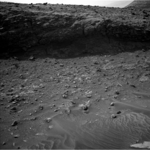
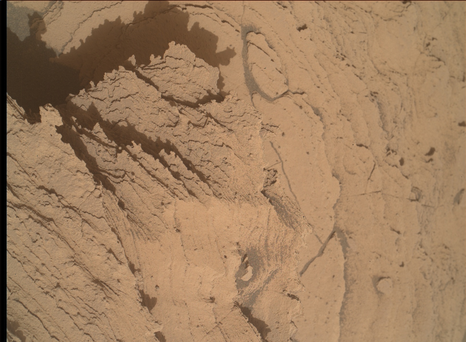
What a wonderful sight to see all the sedimentary structures. I am a geochemist, but I hear the excitement in the voices of my sediment-specialist colleagues, discussing all those textures and things to see. Generally, it is those features that allow us to determine what has happened in terms of the physics: Was it water or wind that brought the grains here? How fast was the flow? And then… what happened next? Well, that might be in my area of expertise, as it takes new minerals to grow between grains to make a loose sediment into a rock. And that's what we can learn from the chemical investigations. And today's plan once again has it all, but it is especially an imaging fest looking at all the structures and textures. Stay tuned for the images to make their way from Mars to Earth in the coming days.
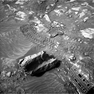
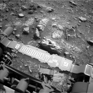
Today's plan starts with the chemistry: APXS will use the cool hours of the early morning for its investigations on the brushed target "Happy Isles." MAHLI will get images of Happy Isles and then move to start the imaging fest at a target named "Laurel Mountain." This is to peak underneath a piece of overhanging rock to see how the layers below are actually connected - or not - to the layers that form the overhang. Spying on rocks? I guess so!
The imaging fest then continues with over 170 Mastcam frames divided into four investigations. These are mosaics on the surrounding hills and slopes, namely on "Pinnacle Ridge," "Milestone Peak" and "Tamarack Flats." And Mastcam looks at the area closer to the rover, off the starboard side, an area where all the structures I talked about above are nicely visible from the rover mast's vantage point. And if that's not enough imaging, we will add some special imaging after the drive. We always take navigation camera images for navigation and imaging purpose during the next planning, but this time, we will also take additional Mastcam images in the drive direction. It's a complex landscape … and I am still happy I can watch the rover drive through it and don't have to hike myself!
There are also plenty of environmental investigations in the plan. The atmospheric investigations include the usual cadence of REMS activities and DAN looks at the water in the subsurface with passive measurements. In addition to that, Curiosity will look at its top surface to look at the dust levels currently accumulated there, and a look to the crater rim will investigate the current opacity of the atmosphere (yes, that's more images, too!). Finally, Curiosity will be on the lookout for some dust devils. We've managed to get a few really nice captures of those in the course of the mission, one of my favourites is this one here, taken on sol 2847, over 1300 sols ago! If you want to see some in motion, here you go: https://www.youtube.com/watch?v=k8lfJ0c7WQ8. Time flies when you are having fun!
Written by Susanne Schwenzer, Planetary Geologist at The Open University