A $2 million package of road safety improvement projects will be rolled out in the Central Goldfields over the next 18 months.
Council is one of 40 Victorian councils to obtain the funding as part of the Victorian Government's Safe Local Roads and Streets program, which is being delivered in partnership with the Traffic Accident Commission.
Central Goldfields Shire Mayor Cr Liesbeth Long said the funding would support Council to ensure community safety on local Council-owned roads.
"As a small rural council, having the funds needed to plan or deliver the safety improvements to reduce road accidents on local roads is really hard and a huge priority for Council.
"That's why we were stoked to be able to secure the TAC funding, as it will mean we can deliver a number of road safety improvements that will mean that our local roads and streets are as safe as possible for all, whether you are a motorist, vehicle passenger, cyclist or a pedestrian."
As part of the funding application, an independent traffic engineering consultant was involved in identifying which sites should be upgraded to ensure they met the specific funding criteria.
Each project had to include the delivery of proven safety infrastructure improvements that were low cost but would decrease the risk of fatal and serious injuries on local roads.
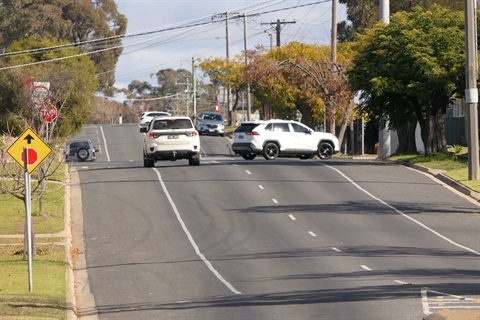
These include zone reductions, construction of splitter islands, alterations to footpaths, creating roundabouts and new zebra crossings at locations.
The locations were based on sites that were identified as being potentially unsafe based on a risk analysis. Community concern around a number of locations was also taken into consideration.
The projects will be delivered in a staged approach over the coming 18 months. Impacted residents, business owners and the wider community will be kept informed as projects are about to commence.
The projects to be delivered include:
Avoca Road, Talbot – Speed zone reduction
The section of road is a 100km/hr local road which runs between Talbot and the Pyrenees Highway. The road is a narrow-sealed road with various curves and crests, and significant vegetation. In the past ten years, there have been two casualties and one fatality recorded along this section of road.
Proposed safety upgrade works include:
- Reducing the speed limit from 100km/hr to 80km/hr, and
- Providing additional curve warning signage.
Clarendon Street, Dundas Road & Palmerston Street, Maryborough – Intersection treatment
The site identified has two T-intersections near each other, creating potential confusion at the intersections. The intersections have site distance issues and reported speeding issues. There was one reported collision recorded at the site.
Proposed safety upgrade works include:
- Constructing a splitter island on Dundas Road,
- Banning the right turn movement out of Palmerston Street, and
- Realignment of footpaths and road narrowing.
Multiple intersections in Maryborough (six sites)
- High Street/Kars Street
- Wills Street/Clarendon Street
- Burke Street/Brougham Street
- Burke Street/Hilton Street
- Napier Street/Hilton Street
- Alma Street/Brougham Street
The six intersections were identified as experiencing high vehicle speeds and vehicles not adhering to the priority of the intersections, such as giving way and stopping. This resulted in the potential for vehicles driving through the intersection and experiencing near misses or vehicle collisions.
Proposed safety upgrade works include:
- Constructing splitter islands at the approaches to the intersection holding line,
- Raising flat top road hump on the approach only to the intersection, and
- Alterations to footpath as required.
Napier Street and Brougham Street, Maryborough
The intersection connects to arterial roads (Pyrenees Highway to the north and Derby Road to the west) and is utilised as a shortcut into Maryborough's Central Business District area. Given the wide streets and the vehicle speeds along Napier Street, the intersection was deemed high risk for potential vehicle incidents.
Proposed safety upgrade works include:
- Constructing a mountable roundabout, and
- Constructing splitter islands to approaches to narrow road carriageway and create horizontal deflection through the roundabout.
Burns Street and Nolan Street intersection, Maryborough
The intersection is a crossroad configuration with offset approaches from Nolan Street. The configuration of this large intersection has been identified as having the potential to create confusion due to the priority of the traffic movements through the intersection. There are statistics from traffic counts showing drivers exceeding speed limits along Burns Street, making this a high-risk area for possible incidents and a hazard for pedestrians negotiating the intersection.
Proposed safety upgrade works include:
- Constructing a roundabout with raised approaches on all legs of the intersection, and
- Constructing zebra crossings in Burns Street (east approach) and Nolan Street (south approach)


