Researchers have uncovered a vast and well-preserved network of ancient irrigation canals in the Eridu region of southern Mesopotamia, shedding new light on early farming practices.
The research team, led by geoarchaeologist Jaafar Jotheri, discovered an extensive system of water management that predates the first millennium BC.
It offers rare insights into how ancient farmers from the sixth century until the early first millennium BC irrigated their fields using the Euphrates River.
This ground-breaking discovery not only enhances our understanding of ancient irrigation systems but also highlights the ingenuity and adaptability of early farmers.
Ancient landscape
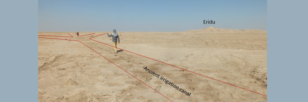
The Eridu region, near Basra in present-day Iraq, remained untouched for centuries due to a shift in the Euphrates' course in the early first millennium BC.
This left the area dry and uninhabited, thus preserving the ancient landscape, unlike other parts of Mesopotamia where older irrigation systems were buried beneath newer canals or river sediments.
By combining geological maps, satellite imagery, drone photography and fieldwork, researchers identified over 200 primary canals directly connected to the ancient Euphrates.
Additionally, more than 4,000 smaller branch canals were mapped, linked to over 700 farms.
Advanced techniques
This complex irrigation network reflects the advanced water management skills of ancient Mesopotamian farmers, who used the natural landscape to their advantage.
The high river levees allowed water to flow by gravity to surrounding fields, while breaks in the levees, known as crevasse splays, helped distribute water across the floodplain.
These techniques enabled farmers to cultivate crops on both sides of the river, although the northern side was more heavily farmed.
Centuries of knowledge uncovered
The study also highlights how the irrigation system evolved over centuries.
The canals required significant labour and expertise to maintain, suggesting that different parts of the network were likely used at different times.
Further research aims to date each canal to better understand changes in farming practices over time.
Comparing the canal designs with descriptions from ancient cuneiform texts could provide even more insight into agricultural management in Mesopotamia.
The project was funded by the British Institute for the Study of Iraq in London and is a collaboration between Durham, the University of Al-Qadisiyah in Iraq and Newcastle University, UK.


