4 min read
Arctic sea ice retreated to near-historic lows in the Northern Hemisphere this summer, likely melting to its minimum extent for the year on Sept.11, 2024, according to researchers at NASA and the National Snow and Ice Data Center (NSIDC). The decline continues the decades-long trend of shrinking and thinning ice cover in the Arctic Ocean.
The amount of frozen seawater in the Arctic fluctuates during the year as the ice thaws and regrows between seasons. Scientists chart these swings to construct a picture of how the Arctic responds over time to rising air and sea temperatures and longer melting seasons. Over the past 46 years, satellites have observed persistent trends of more melting in the summer and less ice formation in winter.
Credit: NASA's Goddard Space Flight Center
Tracking sea ice changes in real time has revealed wide-ranging impacts, from losses and changes in polar wildlife habitat to impacts on local communities in the Arctic and international trade routes.
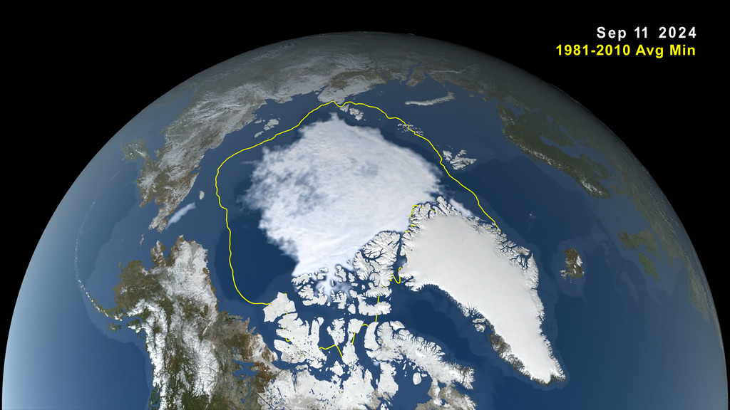
This year, Arctic sea ice shrank to a minimal extent of 1.65 million square miles (4.28 million square kilometers). That's about 750,000 square miles (1.94 million square kilometers) below the 1981 to 2010 end-of-summer average of 2.4 million square miles (6.22 million square kilometers). The difference in ice cover spans an area larger than the state of Alaska. Sea ice extent is defined as the total area of the ocean with at least 15% ice concentration.
Seventh-Lowest in Satellite Record
This year's minimum remained above the all-time low of 1.31 million square miles (3.39 million square kilometers) set in September 2012. While sea ice coverage can fluctuate from year to year, it has trended downward since the start of the satellite record for ice in the late 1970s. Since then, the loss of sea ice has been about 30,000 square miles (77,800 square kilometers) per year, according to NSIDC.
Scientists currently measure sea ice extent using data from passive microwave sensors aboard satellites in the Defense Meteorological Satellite Program, with additional historical data from the Nimbus-7 satellite, jointly operated by NASA and the National Oceanic and Atmospheric Administration (NOAA).


