Related Links
The tornado was on the ground for less than 10 minutes, but it left a tall order for the 188th Civil Engineering Squadron to tackle: get the base back on mission as quickly as possible.
Master Sgt. Brandon Louderback, a 188th CES engineer assistant, was faced with the task.
First, a damage assessment would need to be conducted and then verified. This process involves sending personnel across the base to catalog damaged structures. Their report would then be verified by engineering assistants, who would inspect each structure to build an estimate of the repair cost. Finally, the engineer assistants' reports would be compiled into one report and a request for funds would be sent to higher headquarters for approval.
Louderback was able to slash the time taken to conduct the damage assessment and write the report through an innovative use of Geographic Information Systems - getting the funding request out the door in less than half the time.
"The standard way to conduct a damage assessment more than doubles the work required," Louderback said. "Instead, I entered everything into a GIS app on my tablet, which is already doing the write-up and calculating cost estimates in real time. By the time I get back to my office, the report is ready to go; I just have to organize it onto a spreadsheet."
Louderback was able to conduct the assessment and write up by himself in an afternoon.
The 188th CES leadership is glad to be reaping the benefits of Louderback's skill and experience. Lt. Col. Riley Donoho, deputy base civil engineer, praised Louderback's innovation in getting the $300,000 worth of repair projects jump-started and swiftly sent for approval.
"Master Sgt. Louderback has done a phenomenal job so far in getting us to a better level of organization in projects and in work order tracking," Donoho said. "Concerning the tornado specifically, he was able to document all damage on his phone and update our GIS to efficiently create projects that addressed all the damage."
The Fort Smith tornado wasn't Louderback's first time dealing with a storm's aftermath. As an engineer for the City of Joplin, Missouri, he was on hand when an EF-5 tornado leveled the town in May 2011. He saw firsthand how to leverage the power of a GIS system to solve complex logistical and organizational problems quickly.
"GIS took something massive and made it relatively simple," Louderback said. "For example, firefighters were able to clear buildings and keep track of everything on a tablet. 'This structure is clear, that one needs additional resources.'"
"A lot of the damage information was gathered through using GIS, and up-channeled to (the Federal Emergency Management Agency) for accurate damage assessments," he said. "We could tell you exactly the assessed values of every single house that was lost, all the commercial assessments, too. It was just a matter of writing the right queries to our database."
Louderback advocates for greater integration of GIS to accomplish the mission, making his pitch to sections across the base and the National Guard Bureau in Washington, D.C.
"I've been in the GIS engineering world for 15 years, and I have never seen a career field that couldn't benefit from GIS in some respect."
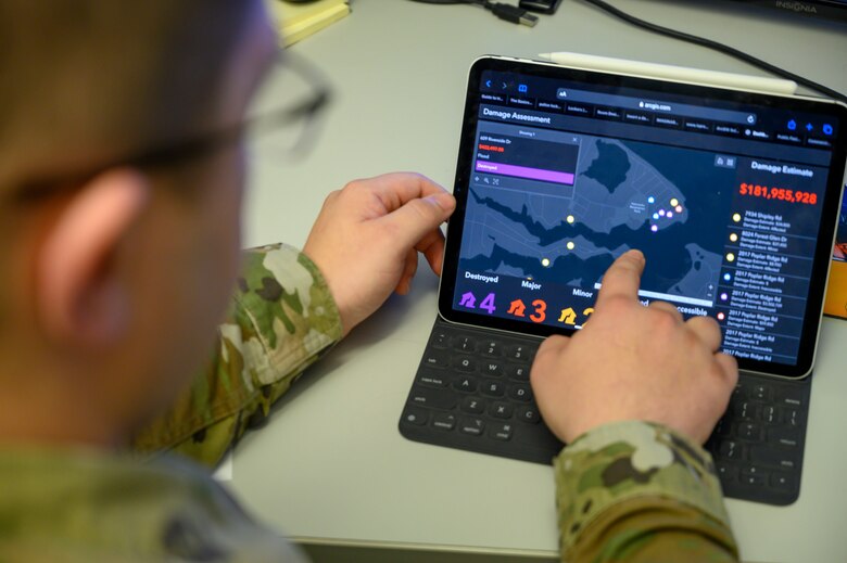
Master Sgt. Brandon Louderback, a 188th Civil Engineering Squadron engineer assistant, Arkansas Air National Guard, demonstrates Geographic Information System surveying capabilities during a training exercise at Ebbing Air National Guard Base in Fort Smith, Ark., March 4, 2020. (U.S. Air National Guard photo by Staff Sgt. Matthew Matlock)
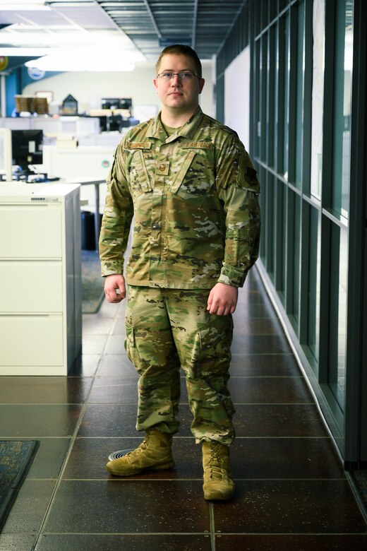
Master Sgt. Brandon Louderback, a 188th Civil Engineering Squadron engineer assistant, poses for a photo at Ebbing Air National Guard Base in Fort Smith, Ark., March 4, 2020. Louderback is pushing for greater Geographic Information System integration in the Air National Guard after showcasing its ability to reduce manpower to assess damage after an EF-1 tornado tore through the base in 2019. (U.S. Air National Guard photo by Staff Sgt. Matthew Matlock)


