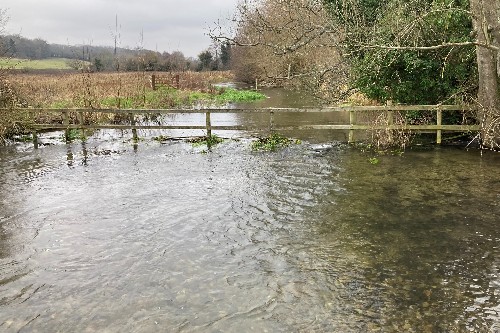
Image shows a flooded River ChessFDRI
Predicting where future fooding and droughts will strike next in the UK is set to become easier with a pioneering initiative harnessing the latest technology and real-time data.
The Floods & Droughts Research Infrastructure (FDRI) project, announced today, will be the first UK-wide network focused on understanding the impact of extreme weather conditions across the country, pinpointing where incidents are likely to occur and planning to limit their impact.
Led by the Natural Environment Research Council (NERC) and the UK Centre for Ecology & Hydrology (UKCEH) and backed by £40 million, researchers will be based at UKCEH offices throughout the UK, with further input from experts at the University of Bristol, Imperial College London, and British Geological Survey.
Dr Gemma Coxon, Associate Professor in Hydrology at Bristol's Cabot Institute for the Environment, said: "The UK Floods and Droughts Research Infrastructure will transform our understanding of when and why floods and droughts occur. I am excited to be leading the capacity building programme delivering training, skills sharing, collaborative working and fostering the development of the next generation of hydrologists."
Deploying sensors in UK rivers and real-time computer monitoring to gather data which will help forecast likely flashpoints are amongst the new techniques planned.
The work will help key bodies, like local authorities and the Environment Agency, to stem the impact extreme weather has on communities, saving lives, homes, and businesses, whilst also helping to reduce related costs to the UK economy, estimated at £740m a year.
The complexity of Earth's climate makes forecasting floods and droughts a major challenge, with climate change further complicating the picture.
Researchers will draw on a huge bank of data including river profiles and near real-time monitoring of information including on atmospherics, ground saturation, water movement, abstraction and storage. Together this will help form a clearer impression of where and when extreme weather is likely to strike.
Floods wreak havoc on communities by destroying homes, public infrastructure, and livelihoods like farming which in turn costs consumers. Similarly, droughts have a major impact on the water supply and UK eco-system, harming wildlife and their natural habitats which rely on regular rainfall.
Findings from the project will be shared with key bodies like the Environment Agency to steer the UK response to extreme weather. It will also act as a hub for researchers to pursue new innovations with discoveries shared across the world and marking the UK as a leader in the field.
Science and Technology Secretary, Peter Kyle, said: "Flooding and droughts can devastate UK communities, from leaving people stranded, to destroying homes, gardens, roads and businesses, and even claiming lives.
"With climate change sadly making extreme weather events more common and adding an eye-watering cost to the economy, there is no time to waste in backing our researchers and innovators to ensure we are better prepared for floods and droughts striking.
"This project will help drive that progress, with dedicated teams using the most advanced tech to crunch data gathered from our rivers and paint a clear picture of its likely impact – using the power of science and tech to keep the public safe."
The new measures build on £5.6bn of Government investment into flooding from 2021 and 2027, with over 100 and coastal risk management projects helping to better protect thousands of people and properties from flooding from the sea, rivers and reservoirs.


