Lithgow City Council has expressed frustration at the slow pace of a government agency to repair subsidence which has forced the closure of Browns Gap Road. Underground mine workings next to the road have threatened the stability of the road above. The Council has been pushing for Subsidence Advisory NSW, a department of the NSW Government, to respond more quickly with their restoration works.
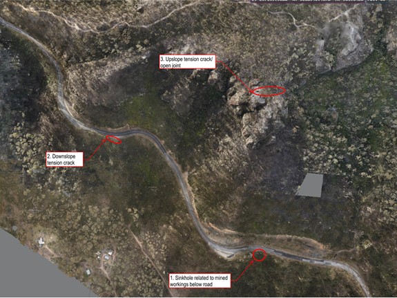
Council has studied the road embankment conditions as they have been affected by the considerable rainfall across the city. Three hazards were identified. These hazards pose a large risk to road users.
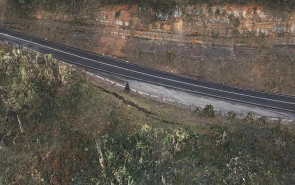
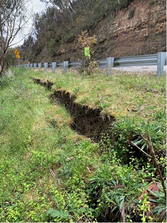
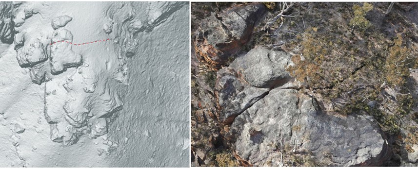
In order of risk significance, the first identified hazard is a sinkhole within the road reserve which is related to mine workings below the road. The second hazard, which cannot acted on until the first is resolved, is a downslope tension crack which is approximately 20 metres long, 1 metre deep and 0.5 metres wide. The last identified hazard is a joint/tension crack, estimated to be in excess of 50 metres in length and 0.5m in width) in the rock outcrops high above the road surface.
The Council is readying for their work to commence as soon as Subsidence Advisory NSW repair the mine subsidence. A slope risk assessment and remediation plans are being developed. These plans will also establish the safety requirements so workers can safely access the site for mapping and rock scaling the frail embankments.
Until these hazards are resolved, at least in part through the rehabilitation of the mine subsidence, a road closure is the only method available to reduce risk to motorists to an acceptable level. The Council remains committed to re-opening the road.

Image 1: Location Map of Three Main Hazards

Image 2: Downslope tension crack - Approximately 20m long.

Image 3: Downslope tension crack

Image 4 & 5: Joint/tension crack - Approximately 50m length


