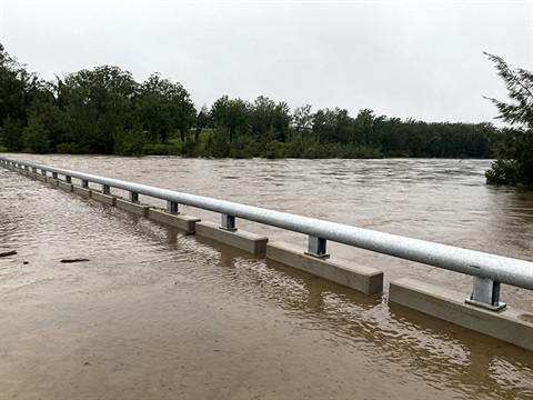
Residents will soon be able to source more information on river levels for the Upper Macleay during potential flood events.
Kempsey Shire Council are progressing with repairs and upgrades to the network of river level gauges across the catchment.
Council understands the network of Upper Macleay river level gauges has been incomplete for some time and the situation is understandably causing community concern, particularly with recent heavy rainfall.
Repairs have been undertaken at both Toorooka and Wittitrin, both severely damaged by bushfire, and contractors are now looking to solve issues in getting information from the units.
There is an expectation that these two gauges will come back online in coming weeks once these technical issues are addressed and reliable readings are observed.
Other gauges at Bellbrook, Collombatti, Moparrabah and Sherwood are the key focus of $90,000 of Drought Communities Program funding that Council has received, and contractors are being engaged to deliver upgrades at these sites.
Council's Director Operations and Planning, Robert Fish said that while the issues with the network of river level gauges have not yet been entirely resolved, these repairs mark the first of a series of urgent steps being undertaken to restore the network.
"We are relieved to say that our network of gauges is set to see improvements in the near future after the community have weathered long delays," said Mr Fish.
"The Georges Junction river level gauge has been fully replaced recently in partnership with WaterNSW, and some of the key gauges destroyed by bushfires at Toorooka and Wittitrin should be back online in coming weeks once we rectify some technical issues.
"Unfortunately the equipment is complex and technical and by its nature it is not uncommon for faults to be challenging to trace and rectify."
"Once these works are complete we will see a substantial improvement in the upriver network of gauges."
While making progress in repairs to gauges, Council is also advocating at a state level to move river gauges to a central ownership model and a statewide plan to manage them in future.
"At present a number of agencies and Councils are involved in the management framework for river and rain gauges, leading to unnecessary complexity," said Mr Fish.
"Given the critical nature of water supply, emergency management and related issues, Council feels that state-level management, recognising that rivers are not confined to one shire, would make a significant improvement."
Damage to the Shire's flood level gauges peaked during the 2019 bushfires, leaving a significant number of gauges out of commission.
Functional gauges form part of Council's flood management plan and in lieu of a full network of gauges, Council has instead had to provide river level information through communications channels in flood events and Council staff have attended to read gauges and communicated these levels whenever there was a flood risk.
Even with repairs to the gauge network now underway, Council remains committed to publishing flood event information widely and in a timely manner moving forward.
For the present, the fully operational gauge at Georges Creek remains a key indicator of upper catchment river activity and Kempsey Shire Council's online disaster dashboard can be found at https://kempsey.disasterdashboards.com/


