China has deployed its first domestically developed helicopter-borne magnetotelluric detection system, created by the Aerospace Information Research Institute (AIR) of the Chinese Academy of Sciences. This advanced system is being used in high-altitude railway construction projects for geological surveys at elevations up to 5,000 meters, successfully addressing challenges that ground-based surveys often face.
The plateau railway construction project encounters geological challenges. The alignment crosses permafrost zones and alpine regions at elevations of 2,500 to 5,000 meters. The area is susceptible to landslides, earthquakes, and debris flows, with extreme weather and complex terrain complicating traditional surveys and raising the risk of delays and safety issues.
Airborne electromagnetic (AEM) detection technology enables efficient exploration of mineral resources, groundwater reserves, and geological structures by identifying variations in the electrical conductivity of subsurface media. This technology offers advantages, including rapid survey operations, high detection accuracy, and extensive coverage capabilities.
As an essential tool for both resource exploration and engineering geological investigations, AEM proves particularly effective in inaccessible or challenging terrains. These include plateau regions, complex topographies, dense forests, arid deserts, Gobi deserts, and marshland areas, where traditional ground-based methods are often impractical.
Associate Researcher HUANG Ling from AIR explained that the airborne magnetotelluric detection system combines three key technologies: a high-sensitivity three-component magnetic sensor for detecting faint signals, a large dynamic range signal reception and processing system for complex environments, and a stable flight pod for high-altitude operations.
Over nearly two months, the research team completed flight missions covering 5,000 kilometers in harsh, cold conditions, successfully acquiring vital geological information such as deep-seated faults, aquifer structures, and lithological characteristics. This data facilitated accurate identification of potential geohazard zones, supporting railway alignment design for enhanced safety and stability.
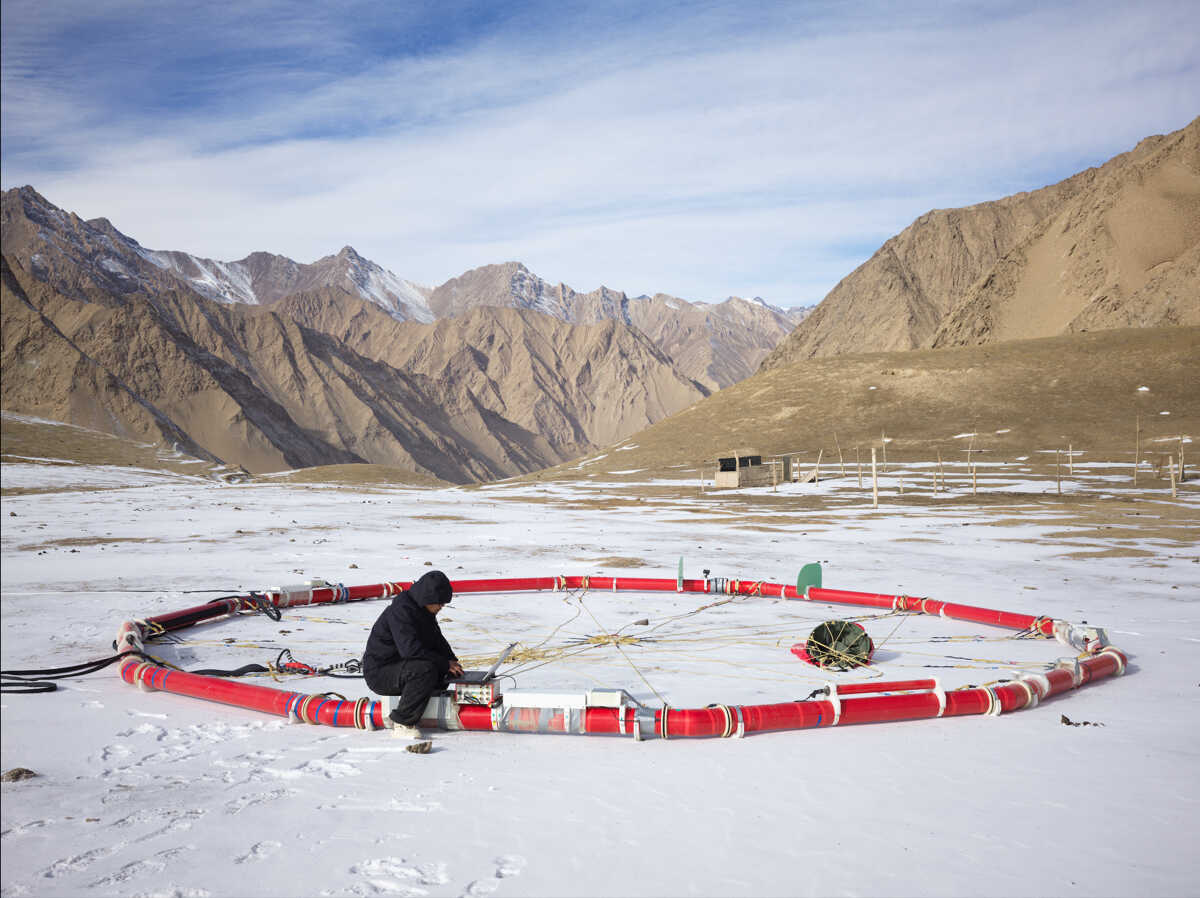
A researcher staff tests the helicopter-borne magnetotelluric detection system. (Image by AIR)
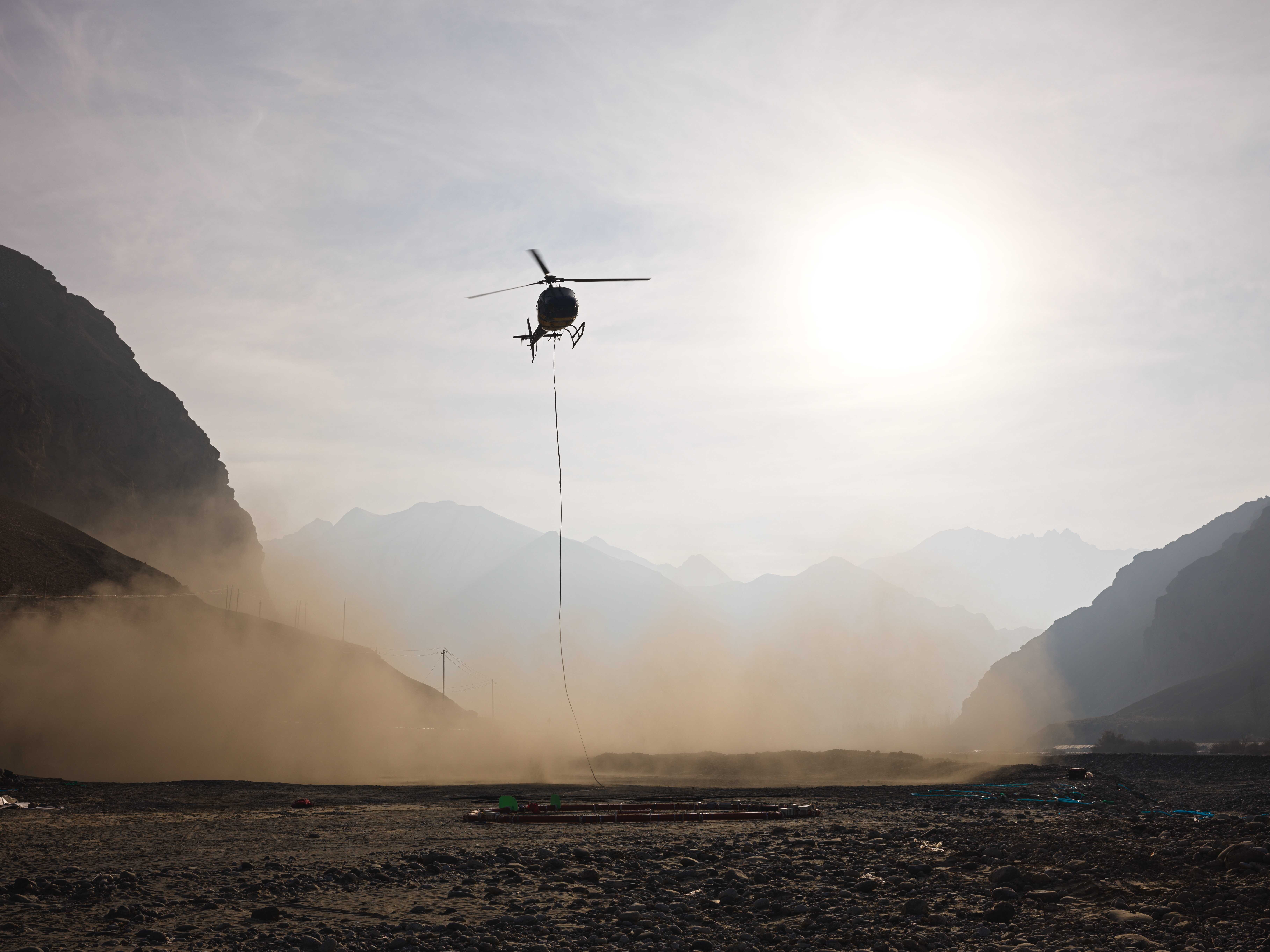
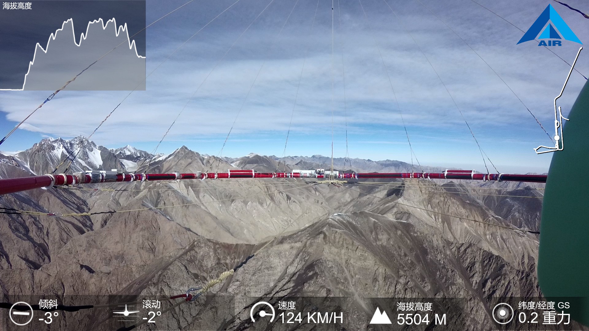
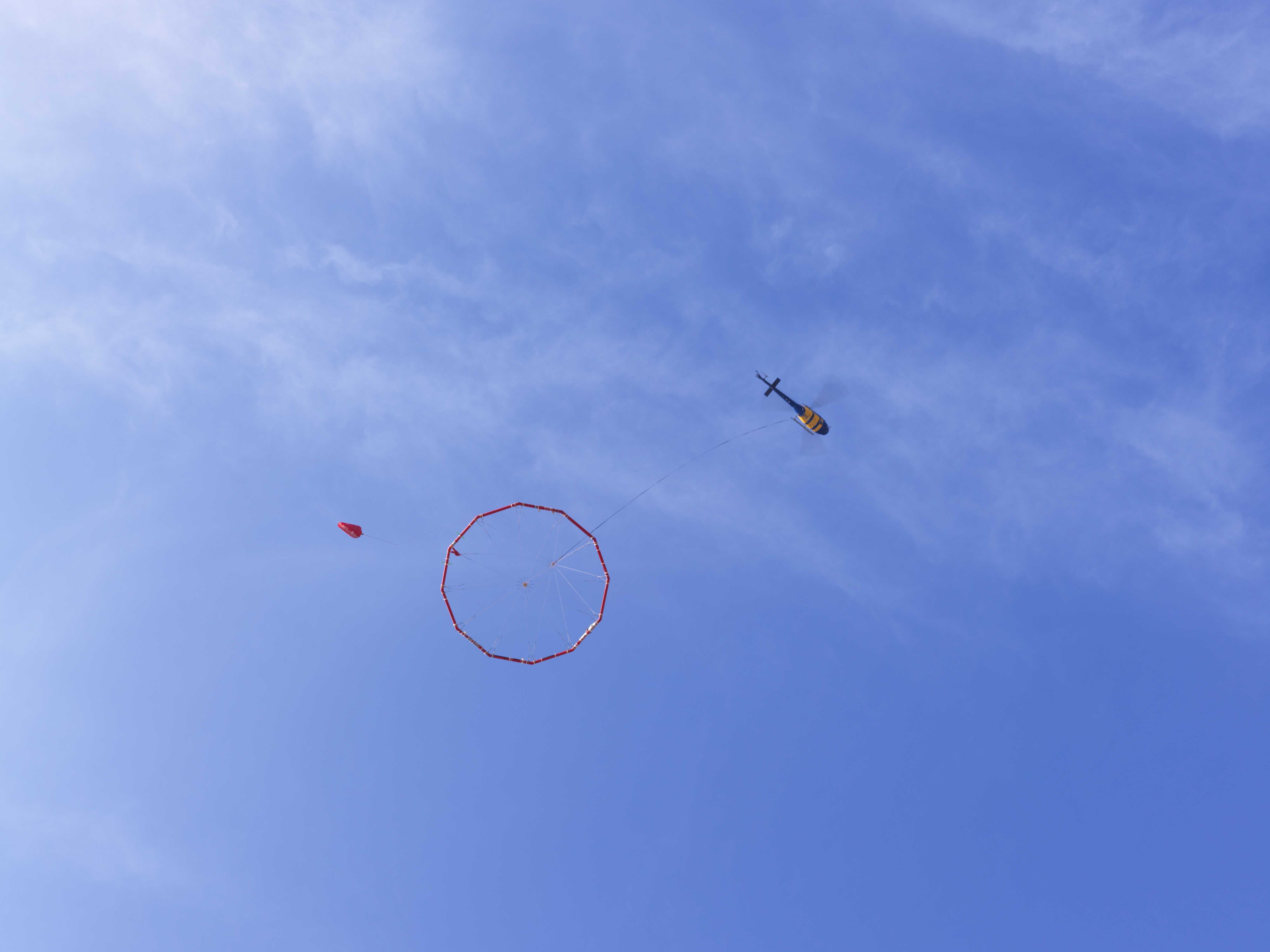
Operational scenarios of China's first helicopter-borne magnetotelluric detection system. (Image by AIR)


