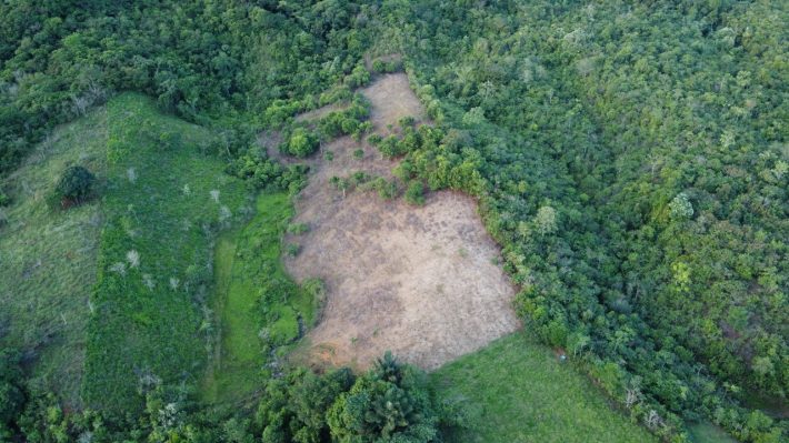
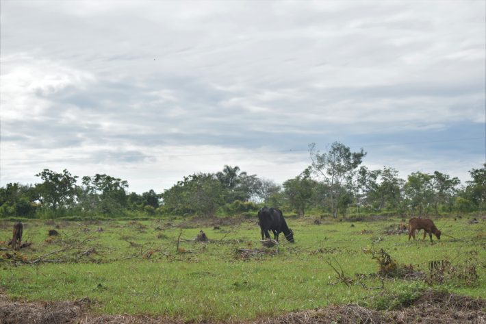
Oxford and international research partners reveal institutionalised cattle ranching and land-grabbing are the key drivers of Colombia's increasing wildfires, according to local stakeholders. The findings are published in People and Nature.

On 24 November 2016 the Revolutionary Armed Forces of Colombia signed an historic peace agreement with the Colombian government. Since then, wildfires in the Tinigua-Picachos-Macarena protected areas have increased sixfold, putting biodiversity and local livelihoods at risk (Armenteras , Schneider and Dávalos, 2018).
Despite the peace agreement, armed groups continue to occupy areas of forest, which alongside a lack of infrastructure including limited access to electricity or mobile signal, makes conducting data-based research to determine the causes of wildfires difficult
Researchers at the Environmental Change Institute, University of Oxford, travelled to the region with local partners from the Universidad Nacional de Colombia, who have been carrying out long-term studies of fire dynamics in the region. Together with researchers from the Universidad de la Amazonia, they conducted interviews with local stakeholders under challenging field conditions.

The UK Team applied participatory and cognitive mental mapping in the region, to identify common ground and disagreement between local actors, using visual aids like mindmaps to help draw out the participants' views on the causes of the fires.
'By integrating disparate forms of knowledge through collective, grounded inquiry, participative mapping has the potential to democratise environmental decision-making in post-conflict regions of the Global South,' explain the authors.
The research reveals the perceived impact of unsustainable cattle ranching, land-grabbing and untitled land, which local stakeholders state are precipitating wildfires through forest clearance.
The findings demonstrate a need for caution and 'bottom up' policies as Colombia rolls out its national development plan, which launched in 2018 with a budget of $325 billion and the aim of transforming the country.
If the right approach is not found, up to 50,000ha of land could be lost to cattle pasture, of which 8,000ha would be located in protected areas.
'It's a very complex situation,' stresses lead author Charlie Tebbutt. 'The peace agreement brought a move from coca cultivation to legal agriculture and many farmers freely switched over. But the lack of support for sustainable economic alternatives drove many back towards cattle ranching. To transport diversified products like local fruits you need effective infrastructure, but when roads become impassable during the rainy season, cattle ranching becomes more attractive due to the simple fact that you can walk your produce to market.'
Tebbutt warns that while building new roads might seem an obvious solution, this has an association with increased wildfires. 'At most, the findings point towards better maintenance of existing road networks within the agricultural frontier, rather than a complete overhaul of infrastructure,' he says.
If the right approach is not found, up to 50,000ha of land could be lost to cattle pasture, of which 8,000ha would be located in protected areas.
Tebbutt was an early career researcher when he began the study. Supervised by Dr. Imma Oliveras, ECOLMOD's Professor Dolors Armenteras, and the University of British Columbia's Dr Tahia Devisscher, the team included Colombian research partners – Laura Obando-Cabrera, Maria Meza and Gustavo Adolfo Gutiérrez García, who provided essential contributions in the field and the laboratory. Oliveras and Tebbutt agree that 'without our Colombian partners, this work would have not been possible.'
You can read the full article for free in here:
Tebbutt, CA, Devisscher, T, Obando-Cabrera, L, et al. Participatory mapping reveals socioeconomic drivers of forest fires in protected areas of the post-conflict Colombian Amazon. People Nat. 2021; 00: 1- 16. https://doi.org/10.1002/pan3.10222


