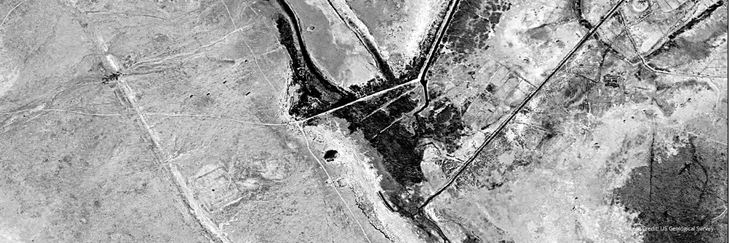
Archaeologists from Durham University and University of Al-Qadisiyah in Iraq have pinpointed the location of a famous early Islamic battle using declassified spy satellite images.
The team, led by Dr William Deadman from our archaeology department, has accurately identified what they believe to be the location of the Battle of al-Qadisiyyah.
The battle, which took place in 637/8 AD, was a crucial victory by the Arab Muslims in the expansion of Islam beyond Arabia. Until now its precise location was not clear.
Rediscovering an ancient battle site
Dr Deadman, a specialist in archaeological remote sensing, was undertaking a remote survey to map out the Darb Zubaydah pilgrimage route when the discovery was made.
The survey involved comparing declassified 1970s American spy satellite imagery to modern day images and historical texts to help identify stopping points along the pilgrimage route.
However, the team realised they were also able to use sites and structures detailed in the historical texts and visible on the satellite imagery, to accurately identify the location of the Battle of al-Qadisiyyah.
Their analysis places the battle site 30km south of Kufa in the Najaf Governorate.
Geographical context
During their survey work the team identified a six-mile-long double wall feature. It linked a military complex on the desert fringe and a large settlement on the edge of the southern Mesopotamian floodplain.
This finding corresponded remarkably well to details within the rich body of historical sources relevant to the battle of al-Qadisiyyah and the stopping points along the Darb Zubaydah.
Colleagues from the University of Al-Qadisiyah in Iraq, were able to provide additional on-the-ground survey evidence to support the original findings.
The team was also able to confidently identify the locations of two stopping points along the Darb Zubaydah – al-Qadisiyyah and al-'Udhayb.
This discovery provides a geographical location and context for a battle that is one of the founding stories of the expansion of Islam into modern day Iraq, Iran and beyond.


