Devastating flooding in East Africa is claiming an increasing number of casualties, destroying infrastructure and crops and killing livestock and wildlife. An incoming tropical cyclone is set to worsen the situation by bringing yet more heavy rainfall to the worst affected countries, including the United Republic of Tanzania and Kenya.
Kenyan President William Ruto addressed the nation, outlining a series of measures to deal with the emergency, including evacuations and urgent health provisions. Water dams are overflowing, roads and bridges have been destroyed, and schools are closed. As of 3 May, 210 people have been killed and many more injured, he said.
"No corner of our country has been spared from this havoc," said President Ruto. "Sadly, we have not seen the last of this perilous period as this situation is expected to escalate. Meteorological reports paint a dire picture. The rains will persist, increasing both in duration and intensity for the rest of this month and possibly after," he said.
The ongoing disaster underlines yet again the vulnerability of society to weather, water and climate-related hazards and the need for Early Warnings For All.
The waning El Niño event, alongside a phenomenon known as the Indian Ocean Dipole, and high sea surface temperatures are playing a role. But the excess energy trapped in the atmosphere and ocean by human-induced greenhouse gases is also having a major influence by turbo-charging the extreme weather.
"The current unprecedented crisis of floods that our country is experiencing …. is a direct consequence of our failure to protect our environment, resulting in painful effects of climate change. Our country will remain in this cyclical crisis for a long time unless and until we confront the existential threat of climate change," said President Ruto.
The Kenya Meteorological Department issued numerous Red Alerts.

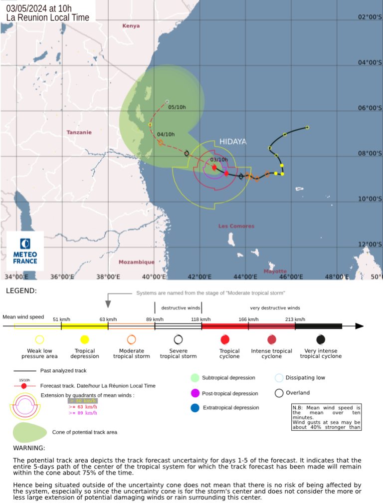
WMO's Regional Specialized Meteorological Centre La Reunion and the Tanzania Meteorological Agency issued respectively advisories and warnings about Tropical Cyclone Hidaya. which is the first documented system to have reached tropical cyclone status in that low latitude region, making it historically significant for the northwestern corner of the South-West Indian Ocean basin.
Hidaya is forecast to bring dangerous waves and heavy rainfall to already sodden soils in Tanzania and also impact northern Mozambique. It is expected to skirt the coastline of those countries for the next couple of days while gradually weakening.
Other countries in the region have also been badly hit, including Uganda, Burundi and parts of Ethiopia and Somalia. This has worsened the already fragile humanitarian situation and displacement crisis in the Horn of Africa.


