Less than a month after intense fires broke out in the Grampians National Park, visitors are being welcomed back to unaffected areas of the park.
The Grampians Tourist Road from Dunkeld to Halls Gap, Wonderland walks north of the Pinnacle and Reeds Lookout will also be reopened before the 26 January long weekend.
Other popular places including Hollow Mountain, McKenzie Falls, Venus Baths, Mt Sturgeon and the northern and southern sections of the Grampians Peaks Trail have already reopened to visitors.

View from Chautauqua Peak: Visitors return to unaffected areas of the Grampians National Park after intense summer fires were quickly controlled.
On 17 December 2024, a lightning strike on Yarram Gap Road, approximately 20km north of Dunkeld in central western Victoria, quickly grew into the first major fire of the 2024-25 summer season. The bushfire emergency triggered a complete closure of the Grampians (Gariwerd) National Park to ensure public safety.

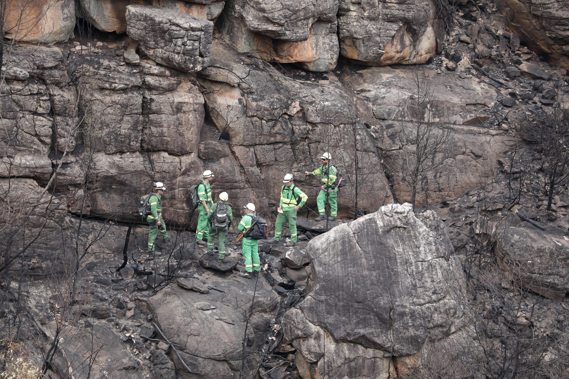
Specialist teams assess damage to the park's key habitats and wildlife populations. The first bushfire of summer 2024-25 affected more than 57,000ha in the Grampians (Gariwerd) National Park.
Working around the clock alongside emergency counterparts from Forest Fire Management Victoria (FFMVic), the Country Fire Authority (CFA) and an interstate contingent, Parks Victoria staff worked to protect local communities, park visitors and the environmental and cultural values of the park.
Eventually encompassing a total of around 76,000ha, including more than 18,000ha of private land, the fire that started on 17 December 2024, was controlled just before midday on 6 January 2025.
Open and safe
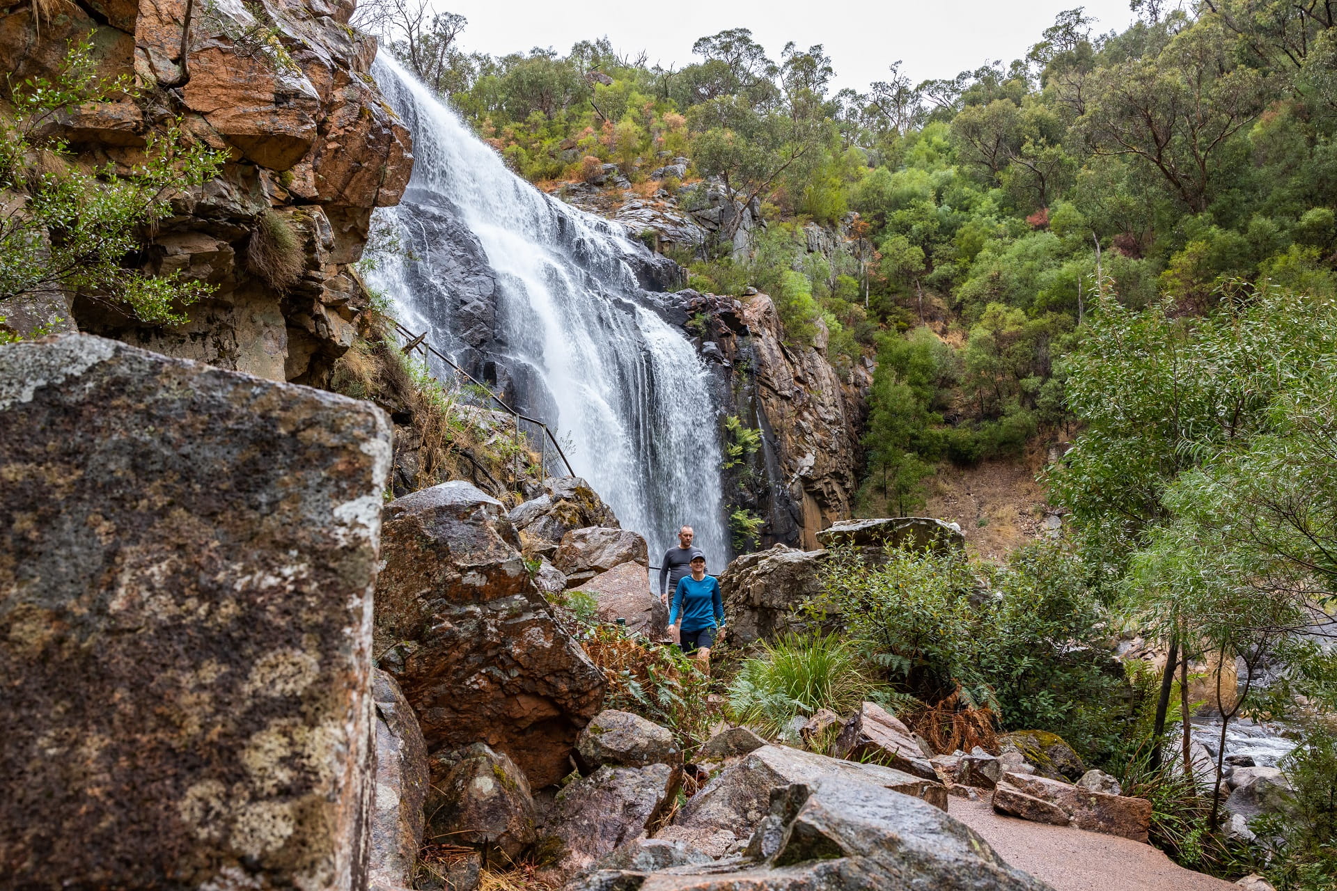
MacKenzie Falls: Popular areas of the Grampians (Gariwerd) National Park, mainly in the north and south,are now open to visitors
The northern and central Grampians re-opened areas include:
- Grampians Peaks Trail The northern section of the spectacular trail is open from Mount Zero to Halls Gap. Experience the panoramic views and hike along rugged rocky ridgelines
- MacKenzie Falls The most iconic and spectacular waterfall in the Grampians. Watch the majestic waterfall from the lookout platform or tackle the steep climb to the base of the falls. Make the most of your day trip in the Grampians National Park with a strenuous walk through the beautiful MacKenzie River Gorge to Zumsteins Historic Area
- Staplyton campground Wake to views over Mount Staplyton abefore exploring the best of the northern Grampians
- Smith's Mill campground Just 1km from popular sights including Mackenzie Falls, and only a short drive to Boroka Lookout and Zumsteins Picnic Area
In the southern and western Grampians, reopened areas include:
- Mt Abrupt (Mud-Dadjug) A challenging grade 4, 6.5km return hike
- Mt Sturgeon (Wurgarri) Ideal for fit bushwalkers, a grade 4, 6.4km trail
- Piccaninny (Baingugg) Close to Dunkeld, this is a grade 3, 2.5km moderate hike
- Grampians Peaks Trail The southern section Dunkeld to Cassidy Gap Road including Dunkeld Trailhead, Victoria Valley Road Trailhead, Picaninny (Bainggug)Trailhead, Mud-Dadjug hike in campground, Djardji-Djawara hike in campground (Start/End Point - no access north of the campground), Cassidy Gap Trailhead)
- Buandik Campground This campground is a great base to explore the Victoria Range and visit the Manja and Billimina Aboriginal rock art shelters.
- Victoria Range Day Walks, overnight hikes and camping (including the Thackery remote camp)
Full details of reopened areas of the park are available on our website's change of conditions page or call into Brambuk the National Park and Cultural Centre in Halls Gap, where park staff can help you plan your visit.
Charlie Richardson, Grampians Area Chief Ranger, said the return of visitors is a welcome relief. "This has been a challenging time for the community and everyone who loves the Grampians. We're delighted to be able to welcome visitors back into the unaffected areas of the park, with a wide range of incredible walks and visitor sites re-opened to the public."
Moving toward recovery
As the transition from emergency to recovery happens, specialist teams from the Department of Energy, Environment and Climate Action and Parks Victoria led rapid risk assessments and impacts on biodiversity and natural values to identify urgent priorities for the recovery phase.Working on the ground and using drones and helicopters, these teams assess damage to the park's infrastructure, key habitats and wildlife populations.

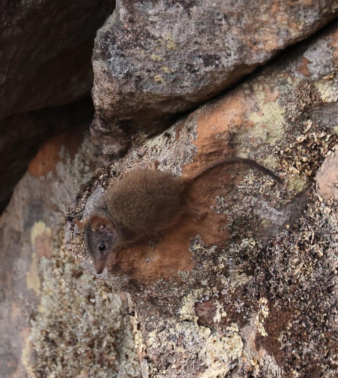
Encouraging signs of life: A vulnerable antechinus in the Grampians National Park after fires were controlled
Saving Brush-tailed Rock-wallabies
Parks Victoria staff were part of a team that dropped emergency food supplies to critically endangered Brush-tailed Rock-wallabies. They live in a rocky escarpment area that's been badly burned and were at risk of starvation. Emergency food drops were conducted via helicopter and drone for vulnerable native animals.
The food drop will help the colony survive the aftermath of the fire. Captive-bred brush-tailed rock-wallabies were reintroduced into the Grampians (Gariwerd) National Park during 2008-12. The team is hopeful the entire colony survived.
Impacts have also been shown on other animals, including the Long-nosed Potoroo and endangered Southern Brown bandicoot. The relocation of threatened species including the River Blackfish is underway.
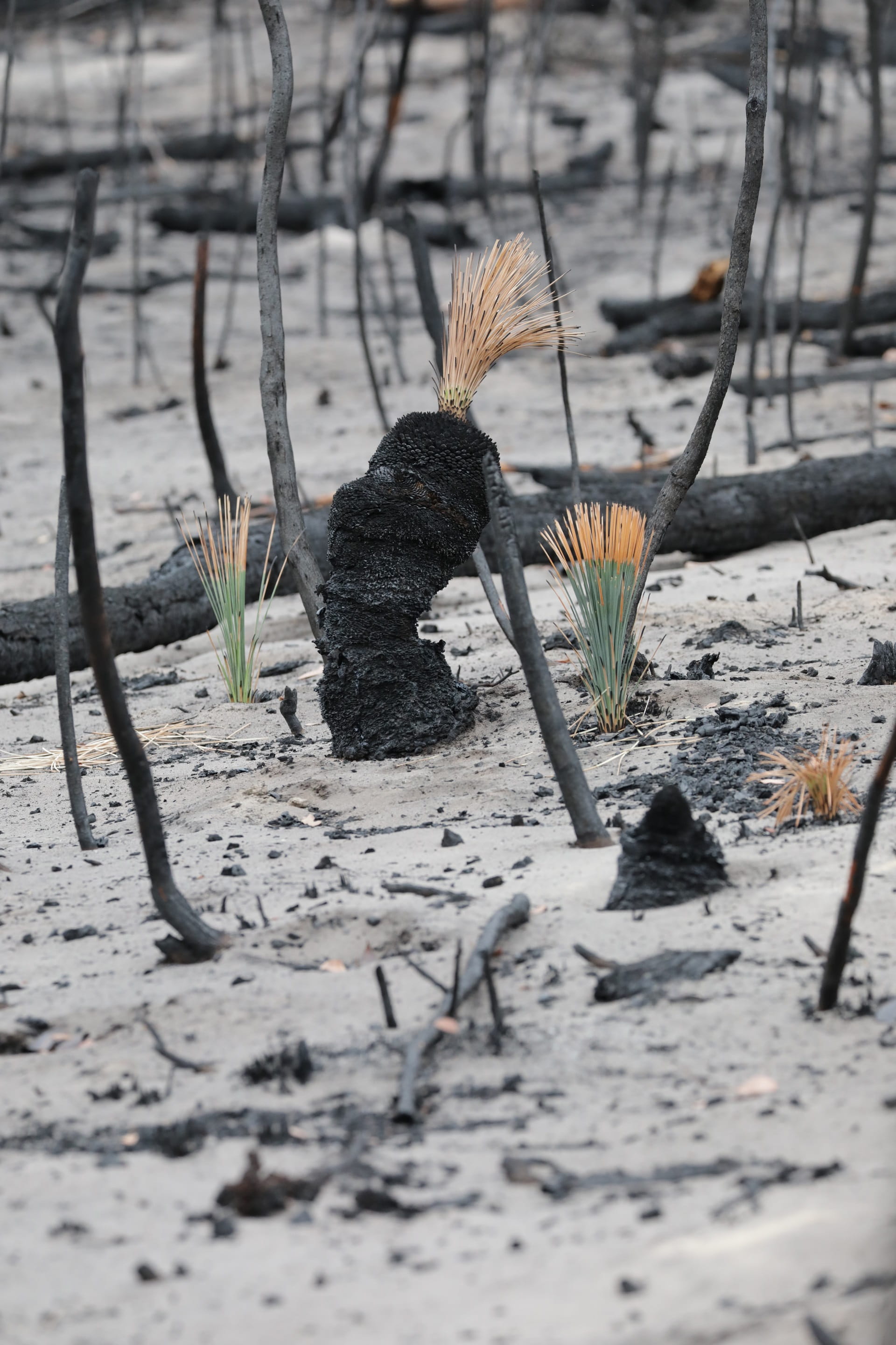
Early scenes in the fireground were sobering, but Mark Norman, Chief Conservation Scientist with Parks Victoria saw signs of recovery. "Fire adapted plants like the Hakea and Banksia have thrown seeds on the ash rich ground so the early signs of recovery are encouraging. In the black summer fires of 2019-20, it burnt the seed down to a meter deep, so I was glad to see burns aren't uniformly harsh."

The native flowering grass trees (Xanthorrhoea) are pyrophytic plants – which means they are adapted to survive in fire-prone habitats.
Visitor awareness
Our rangers will be making sure the reopened areas are safe and clean for people to enjoy. They'll also be putting up signage where needed so people are aware of the areas, tracks and roads that continue to be closed.
Be mindful that conditions can change rapidly and there is still disruption to roads in the area. Visitors should download the free VicEmergency app for the latest updates. For full details on the reopened areas of the park, visit the Park Victoria website or Brambuk the National Park and Cultural Centre in Halls Gap.
Please don't try to go into any closed areas, for your safety, and that of the fire crews.
We acknowledge that the fire has affected the Country of the Djab Wurrung, Jadawadajali and Gunditjmara peoples who have occupied, cultivated and shaped the Gariwerd Landscape for thousands of generations. The Nationally Heritage Listed bio-cultural landscape reflects countless generations of skills, knowledge and culture.


