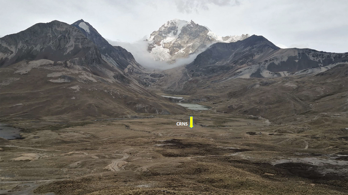
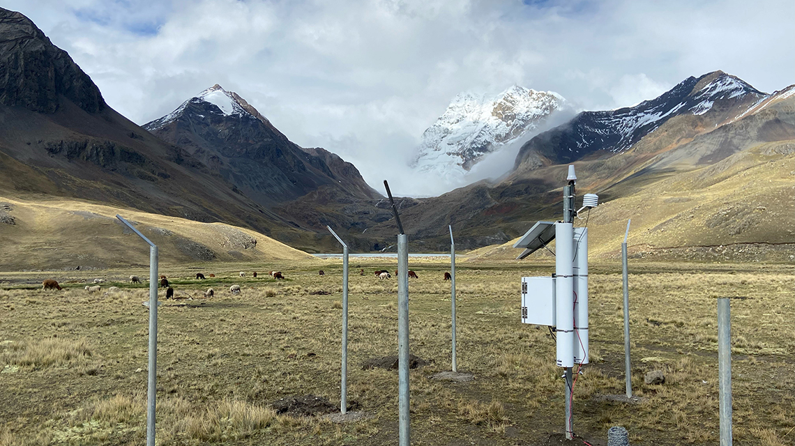
This week, the IAEA, in cooperation with the Food and Agriculture Organization of the United Nations (FAO), delivered equipment to Bolivia to help local scientists study how high-altitude wetlands can buffer water as glaciers disappear. The Cosmic Ray Neutron Sensor (CRNS), which measures area-wide soil moisture, was installed at around 4,500 meters altitude, close to the eternal snow of the 6,088 meters high Huayna Potosi mountain in the Cordillera Real. The device will help scientists, who were trained on its use, to predict the extent and likelihood of droughts, and in turn support decision makers to develop climate-change adaptation strategies for mountain ecosystems.
Since 1980, the Cordillera Real has lost more than a third of its ice surface due to climate change, impacting water supply for millions of Bolivians, sometimes severely. Indeed, without glaciers, reservoirs at the bottom of mountains do not get replenished regularly. The Huayna Potosi's glacier loses two metres in thickness and retreats by 20 metres annually, and is predicted to disappear in 60 years. The glacier feeds the Tuni reservoir, which supplies water to El Alto, a city of 1 million. To mitigate and adapt to frequent severe droughts, early warning systems are needed. This is where nuclear techniques will help.
"The wetlands can buffer the dwindling water supply resulting from shrinking glaciers, but their role under a changing climate remains unclear," said Edson Ramirez, a glaciologist at the San Andrés University in Bolivia and the coordinator of the FAO/IAEA's studies in the Andes. "The Cosmic Ray Neutron Sensor can help determine the amount of moisture, i.e. whether water in wetlands is shrinking, which can affect its availability for the users lower down the mountain."

Location of the Cosmic Ray Neutron Sensor, at the slope of the Huayna Potosi mountain, Cordillera Real, Bolivia. (Photo: Edson Ramirez)
Andean wetlands absorb water derived from snow, glacier meltwater and rain, and slowly release it downstream - providing water supply for cities as well as to pastoralists in the mountains, sustaining livelihoods.
The CRNS, whose installation was supported by the IAEA's technical cooperation programme, will detect and count continuously the number of neutrons in the soil and in the air just above the soil, up to an area of 30 hectares. Scientists will use this information to determine the moisture levels in the soil (see The Science below). In 2020, they received training on how to use the equipment and interpret the data.

Installation of the Cosmic Ray Neutron Sensor, Huayna Potosi mountain, Cordillera Real, Bolivia. (Photo: Edson Ramirez)
The installation of the CRNS in Bolivia is based on innovative R&D activities at the Joint FAO/IAEA Centre for Nuclear Techniques in Agriculture, in collaboration with experts worldwide. Such monitoring system has been applied in many countries, and it is the first time it is applied in a high-altitude region.
"The collection of over 100 soil samples for the CRNS calibration was physically challenging at such an altitude," said Trenton Franz, Associate Director for Research at the University of Nebraska-Lincoln, USA, and lead scientist of this FAO/IAEA mission. "On top of it, the site is currently facing extreme rainfall and lots of mud due to the La Niña phenomenon. These conditions make it clear that the CRNS is the best option to collect precise data in such remote areas under harsh weather conditions".
The CRNS was installed near the property of an 80-year-old local resident, with his approval. Guillermo Aruquipa has seen the glacier melt over time and is concerned about the changes he has observed in ecosystems over the last decades, he said.

Cosmic Ray Neutron Sensor installed in high Andean Bolivian wetlands to study their role in buffering water under climate change. (Photo: Trenton Franz)
The Ministry of Environment and Water of Bolivia plans to deploy Cosmic Ray Neutron Sensors in many places across the country - including in portable versions - to improve current early warning systems for extreme events such as droughts.
Data collected will be shared on the IAEA's Cyber Learning Platform for Network Education and Training created by the IAEA to help countries develop specific climate change adaptation strategies in mountainous regions.


