NASA/Michala Garrison, USGS
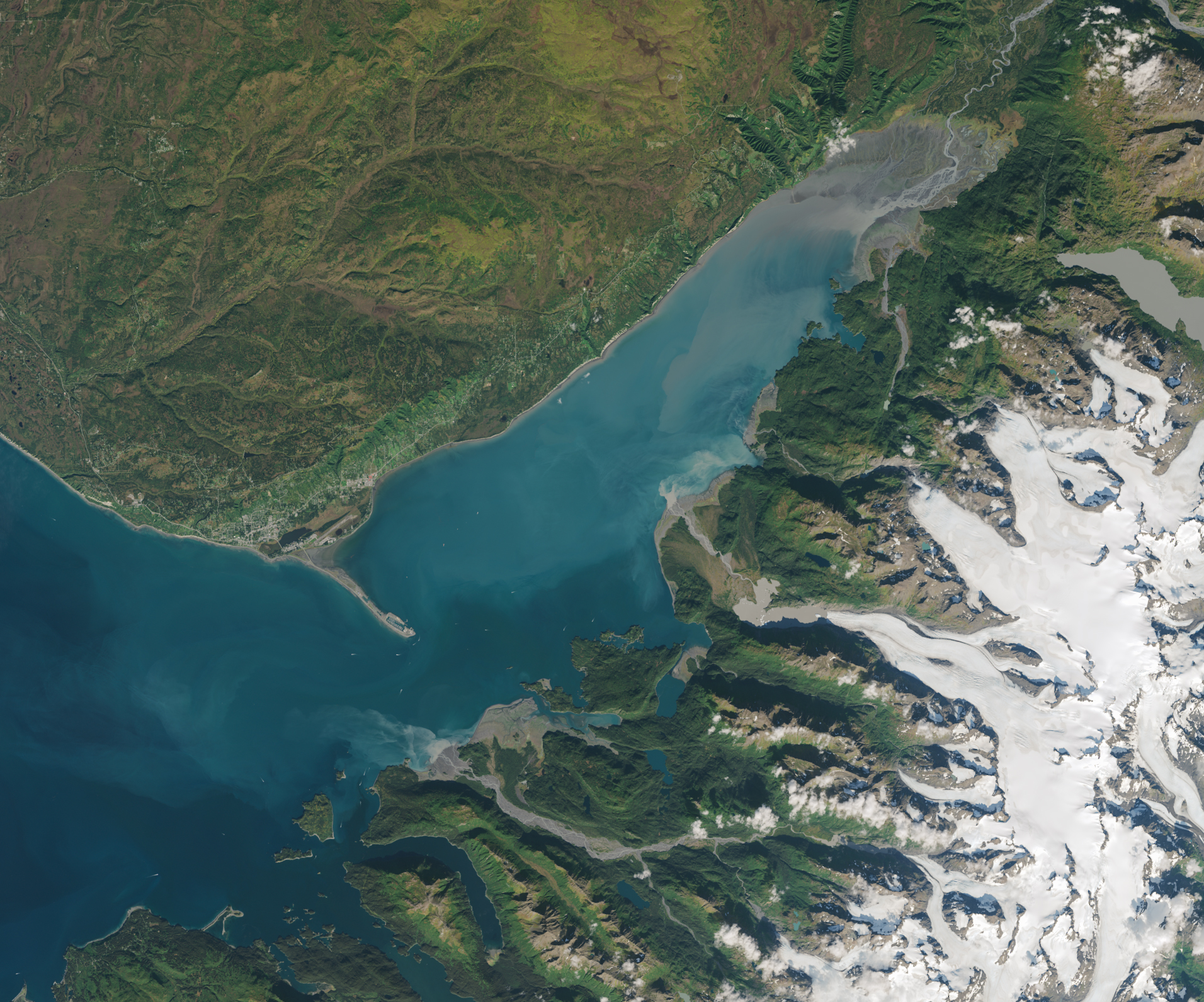
The OLI (Operational Land Imager) on Landsat 8 captured an image of Kachemak Bay's turbid, cloudy waters on September 20, 2024. This cloudiness comes from glacial flour: bits of pulverized rock ground down by glaciers that has the consistency of flour. Several meltwater streams rich with the particles, sometimes called suspended sediment, absorb and scatter sunlight in ways that turn water a milky blue-green hue. The water that flows into the bay from the Grewingk-Yalik Glacier Complex to the east carries sediment-infused waters that transform the appearance of the bay during the summer, raising questions about how much the influx of sediment affects the bay's marine life.
/Public Release. This material from the originating organization/author(s) might be of the point-in-time nature, and edited for clarity, style and length. Mirage.News does not take institutional positions or sides, and all views, positions, and conclusions expressed herein are solely those of the author(s).View in full here.