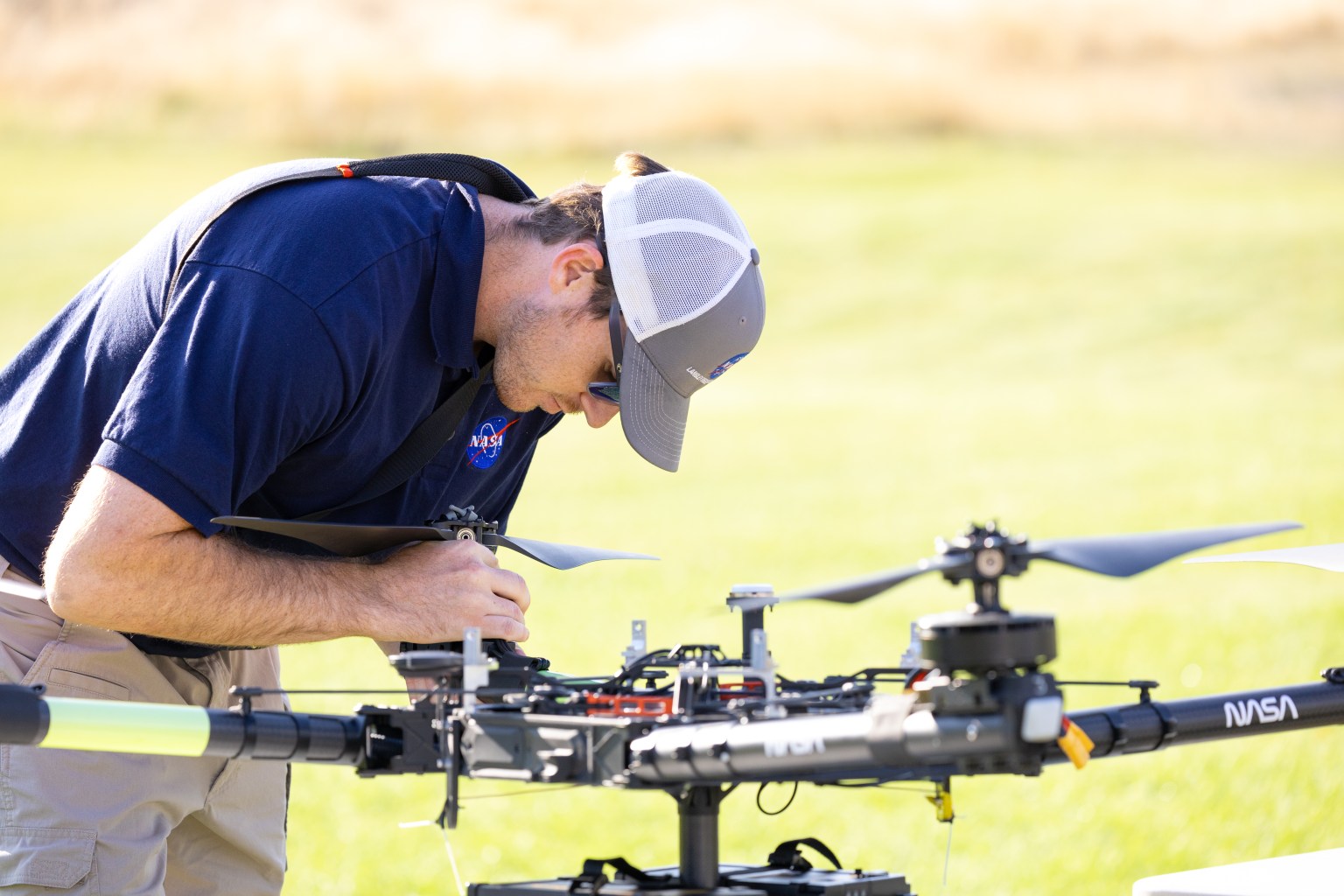
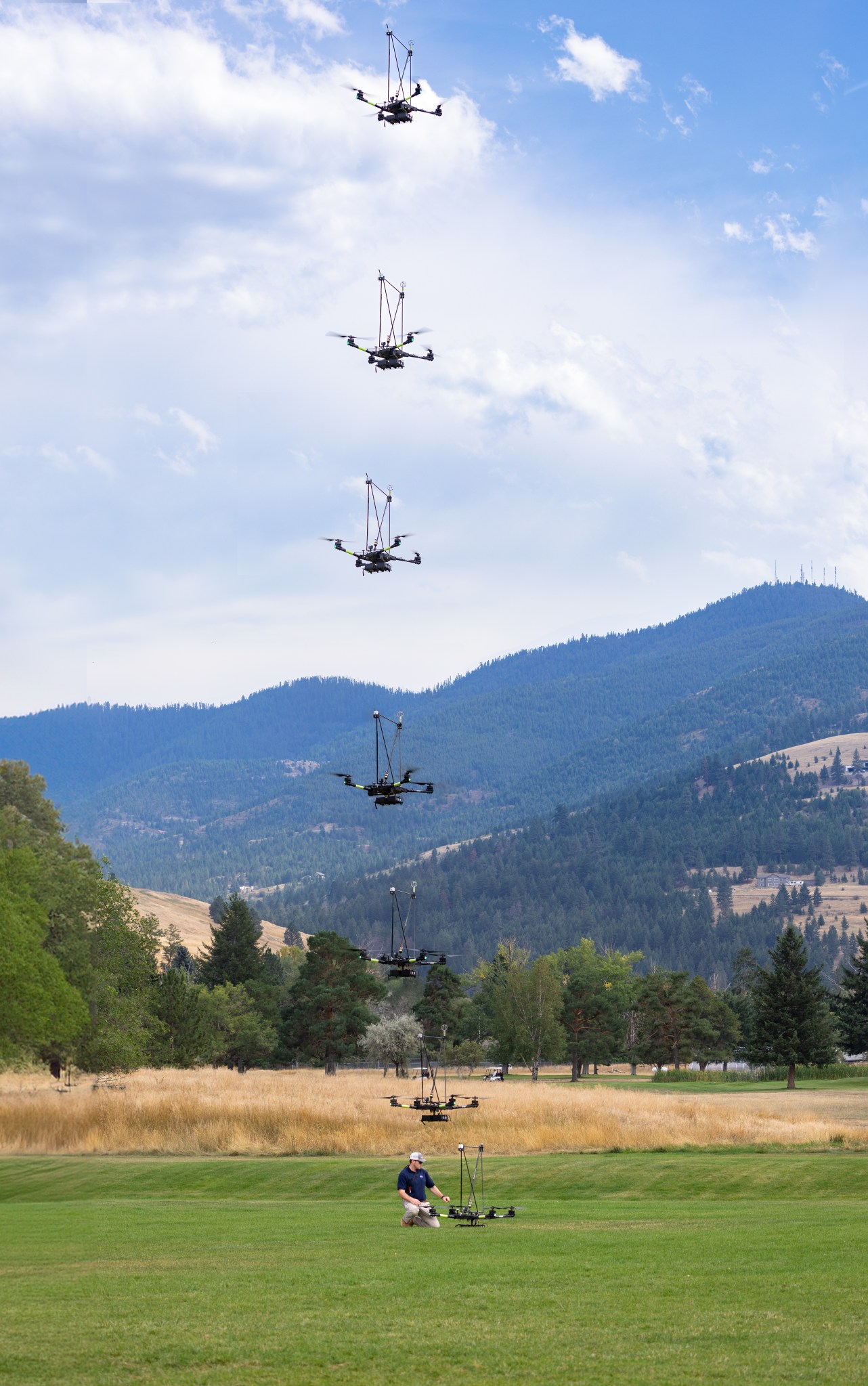
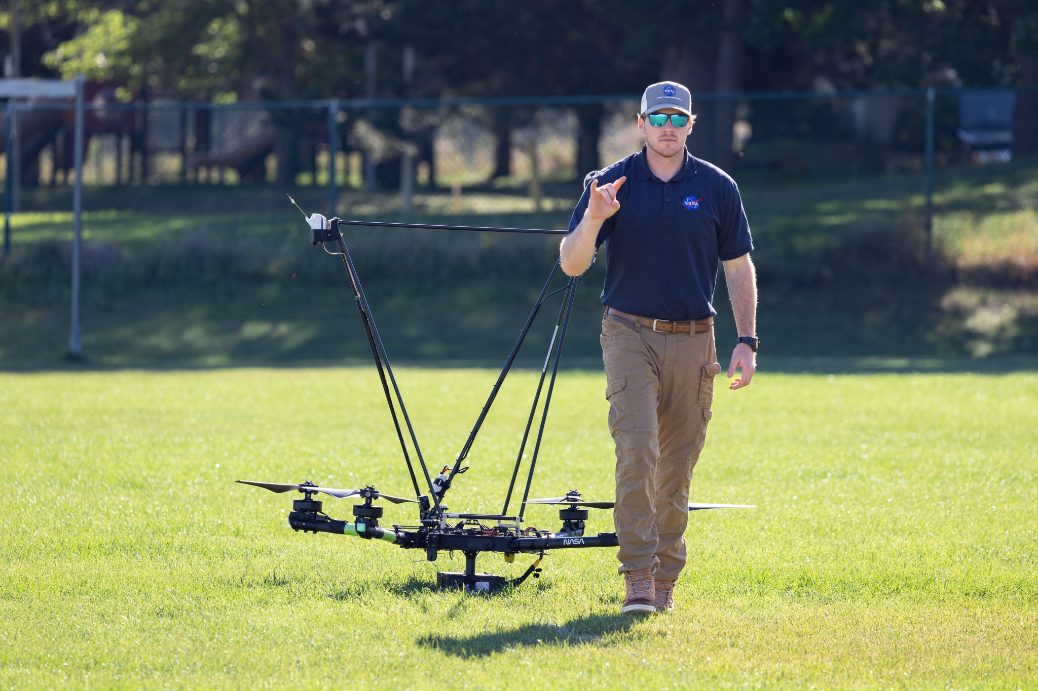
In Aug. 2024, a team of NASA researchers and partners gathered in Missoula, to test new drone-based technology for localized forecasting, or micrometeorology. Researchers attached wind sensors to a drone, NASA's Alta X quadcopter, aiming to provide precise and sustainable meteorological data to help predict fire behavior.
Wildfires are increasing in number and severity around the world, including the United States, and wind is a major factor. It leads to unexpected and unpredictable fire growth, public threats, and fire fatalities, making micrometeorology a very effective tool to combat fire.
The campaign was run by NASA's FireSense project, focused on addressing challenges in wildland fire management by putting NASA science and technology in the hands of operational agencies.
"Ensuring that the new technology will be easily adoptable by operational agencies such as the U.S. Forest Service and the National Weather Service was another primary goal of the campaign," said Jacqueline Shuman, FireSense project scientist at NASA's Ames Research Center in California's Silicon Valley.
The FireSense team chose the Alta X drone because the U.S. Forest Service already has a fleet of the quadcopters and trained drone pilots, which could make integrating the needed sensors - and the accompanying infrastructure - much easier and more cost-effective for the agency.
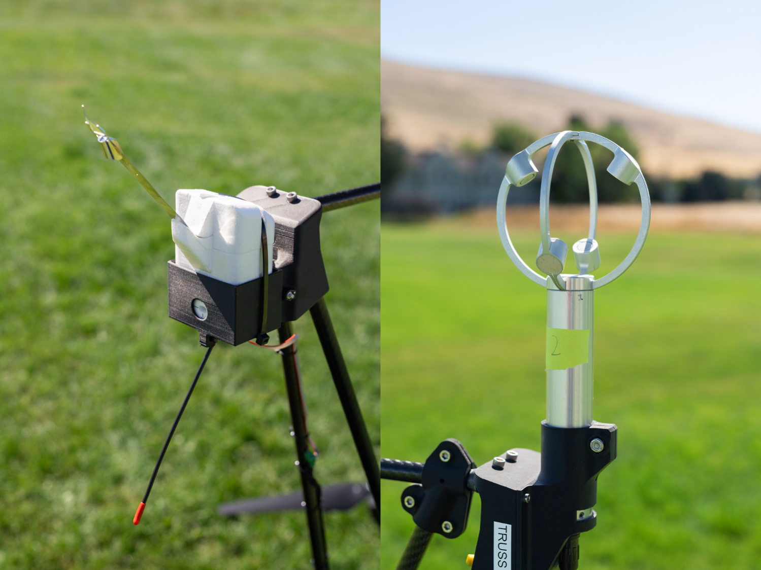
The choice of the two sensors for the drone's payload was also driven by their adoptability.
The first, called a radiosonde, measures wind direction and speed, humidity, temperature, and pressure, and is used daily by the National Weather Service. The other sensor, an anemometer, measures wind speed and direction, and is used at weather stations and airports around the world.
"Anemometers are everywhere, but are usually stationary," said Robert McSwain, the FireSense uncrewed aerial system (UAS) lead, based at NASA's Langley Research Center in Hampton, Virginia. "We are taking a sensor type that is already used all over the world, and giving it wings."


