5 min read

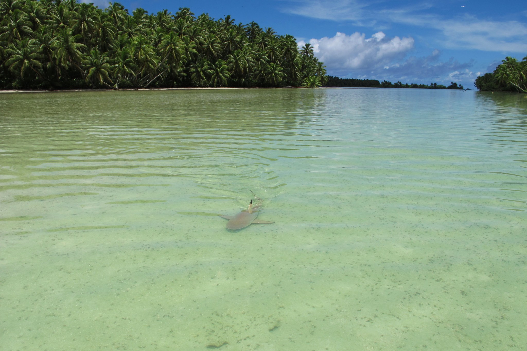
Anchoring the boat in a sandbar, research scientist Morgan Gilmour steps into the shallows and is immediately surrounded by sharks. The warm waters around the tropical island act as a reef shark nursery, and these baby biters are curious about the newcomer. They zoom close and veer away at the last minute, as Gilmour slowly makes her way toward the kaleidoscope of green sprouting from the island ahead.
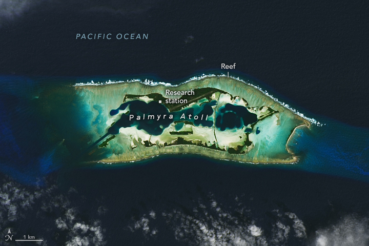
Gilmour, a scientist at NASA's Ames Research Center in California's Silicon Valley, conducts marine ecology and conservation studies using data collected by the U.S. Geological Survey (USGS) from animals equipped with wildlife tags. Palmyra Atoll, a United States marine protected area, provides the perfect venue for this work.
A collection of roughly 50 small islands in the tropical heart of the Pacific Ocean, the atoll is bursting with life of all kinds, from the reef sharks and manta rays circling the shoreline to the coconut crabs climbing palm branches and the thousands of seabirds swooping overhead. By analyzing the movements of dolphins, tuna, and other creatures, Gilmour and her collaborators can help assess whether the boundaries of the marine protected area surrounding the atoll actually protect the species they intend to, or if its limits need to shift.
Launched in 2020 by The Nature Conservancy and its partners - USGS, NOAA (National Oceanic and Atmospheric Administration), and several universities - the project team deployed wildlife tags at Palmyra in 2022, when Gilmour was a scientist with USGS.
Now with NASA, she is leveraging the data for a study under the agency's Internet of Animals project. By combining information transmitted from wildlife tags with information about the planet collected by satellites - such as NASA's Aqua, NOAA's GOES (Geostationary Operational Environmental Satellite) satellites, and the U.S.-European Jason-3 - scientists can work with partners to draw conclusions that inform ecological management.
"Internet of Animals is more than just an individual collection of movements or individual studies; it's a way to understand the Earth at large," said Ryan Pavlick, then Internet of Animals project scientist at NASA's Jet Propulsion Laboratory in Southern California, during the project's kickoff event.
The Internet of Animals at Palmyra
"Our work at Palmyra was remarkably comprehensive," said Gilmour. "We tracked the movements of eight species at once, plus their environmental conditions, and we integrated climate projections to understand how their habitat may change. Where studies may typically track two or three types of birds, we added fish and marine mammals, plus air and water column data, for a 3D picture of the marine protected area."
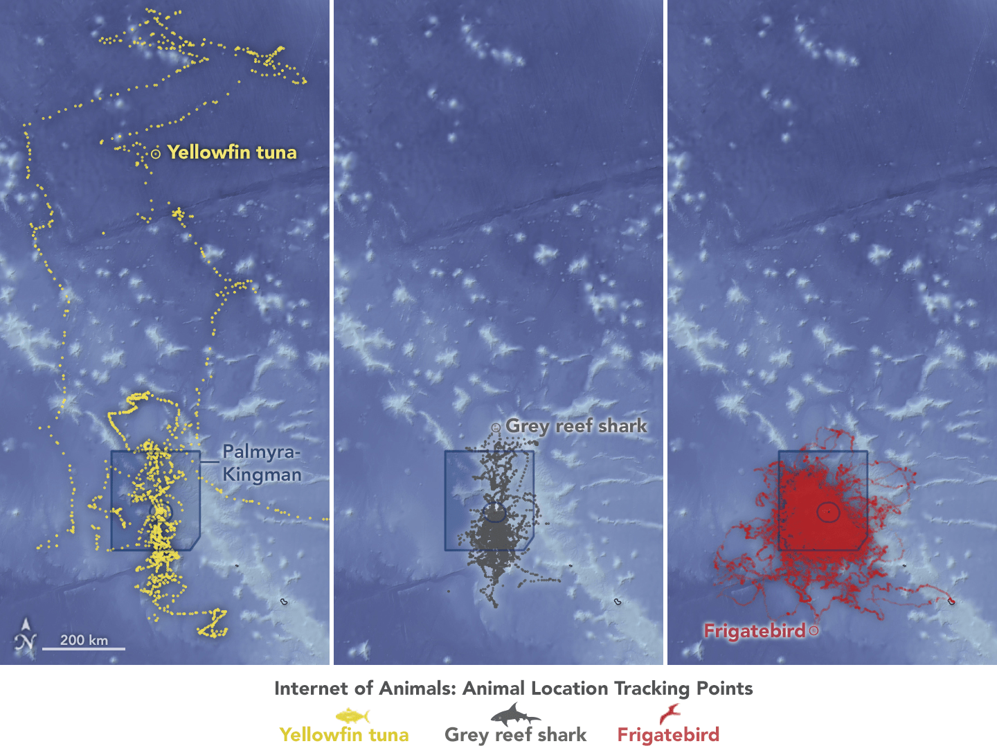
Now, the NASA team has put that data into a species distribution model, which combines the wildlife tracking information with environmental data from satellites, including sea surface temperature, chlorophyll concentration, and ocean current speed. The model can help researchers understand how animal populations use their habitats and how that might shift as the climate changes.
Preliminary results from Internet of Animals team show that the animals tracked are moving beyond the confines of the Palmyra marine protected area. The model identified suitable habitats both in and around the protected zone - now and under predicted climate change scenarios - other researchers and decisionmakers can utilize that knowledge to inform marine policy and conservation.
Following a 2023 presidential memorandum, NOAA began studying and gathering input on whether to expand the protected areas around Palmyra and other parts of the Pacific Remote Islands Marine National Monument. Analysis from NASA's Internet of Animals could inform that and similar decisions, such as whether to create protected "corridors" in the ocean to allow for seasonal migrations of wildlife. The findings and models from the team's habitat analysis at Palmyra also could help inform conservation at similar latitudes across the planet.
Beyond the Sea: Other Internet of Animals Studies
Research at Palmyra Atoll is just one example of work by Internet of Animals scientists.
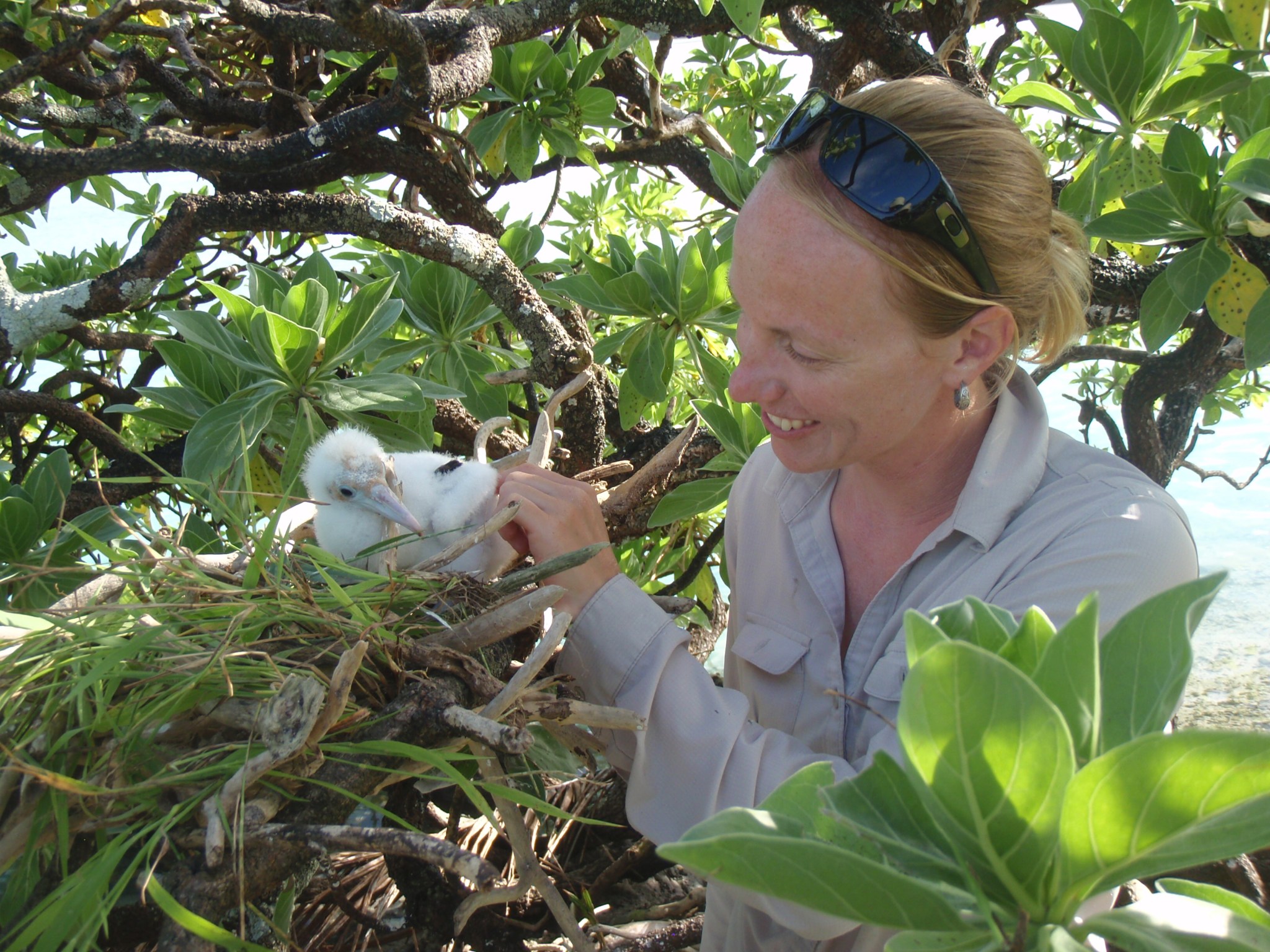
Claire Teitelbaum, a researcher with the Bay Area Environmental Research Institute based at NASA Ames, studies avian flu in wild waterfowl, investigating how their movement may contribute to transmission of the virus to poultry and other domestic livestock.
Teams at Ames and JPL are also working with USGS to create next-generation wildlife tags and sensors. Low-power radar tags in development at JPL would be lightweight enough to track small birds. Ames researchers plan to develop long-range radio tags capable of maximizing coverage and transmission of data from high-flying birds. This could help researchers take measurements in hard-to-reach layers of the atmosphere.


