On Wednesday 9 June and Thursday 10 June 2021, parts of Victoria experienced some of the most severe storm conditions in decades.
More than 3.3 million hectares of land were affected by storm and flood damage, more than 300,000 homes and businesses lost power and more than 500 homes were damaged or destroyed across 34 local government areas.
DELWP personnel worked alongside our emergency services partners in the field and in control centres at incident, region and state levels leading into and throughout the emergency event, and then taking part in the response, relief and recovery operations to help both the community and the land we manage to get back on its feet.
Recovery can take a long time, especially when the impact was as vast as during last year's emergency. Many residents remain displaced in temporary accommodation and are facing ongoing challenges in rebuilding their homes. Our thoughts are with the Victorians who were and still are affected by this significant event.
More than $200 million has so far been allocated through numerous programs and initiatives to support Victorian communities and businesses to build back better and stronger to recover from the incredibly destructive June storms.
This includes $105 million jointly funded with the Commonwealth for the complex clean-up, $8.2 million to impacted councils to coordinate local recovery efforts and $73 million to support DELWP, Parks Victoria and water authorities with a program of recovery work across 2 million hectares of public land.
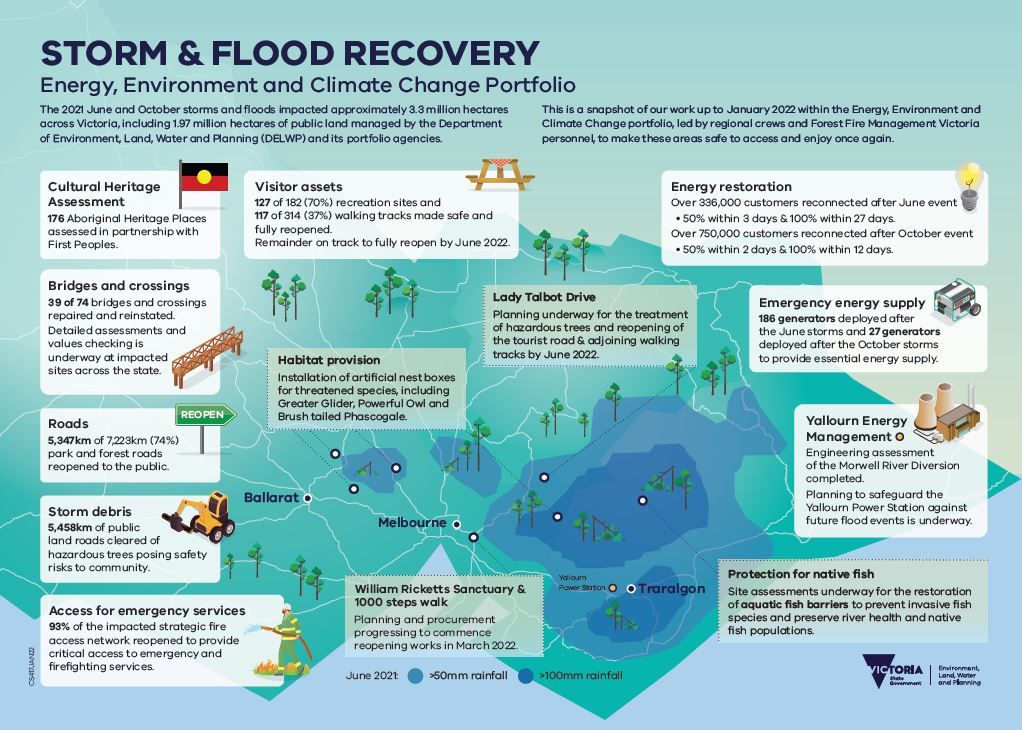
Projects and activities DELWP and our portfolio partners have delivered since the storm and floods* in June last year include:
- Working with councils to support Victorians rebuilding homes that were destroyed in the storms
- Assessing close to 200 Aboriginal heritage places in partnership with Traditional owners
- Assessing impacts on up to 100 historic heritage sites, from historic mine sites across Gippsland to heritage places in the township of Walhalla. The focus of the Gippsland impacts is north of Traralgon and in the Dargo region.
- Repairing and reinstating more than half of the damaged bridges and crossings
- Reopening more than 5,600 kilometres of park and forest roads
- Clearing more than 5,700 kilometres of public land roads of hazardous trees
- Reopening the vast majority of the affected fire access network before the 2021/22 fire season
- Reopening more than 4 in 5 recreation sites and walking tracks that had to be closed following the storms and floods. The majority of the remainder will open by spring.
- Installing dozens of nesting boxes and creating hollows for threatened species in areas where storms damaged habitat
* based on end-of-April 2022 reporting

View a large version of the storm and flood recovery graphic


