NASA/Wanmei Liang, using MODIS data from NASA EOSDIS LANCE and GIBS/Worldview
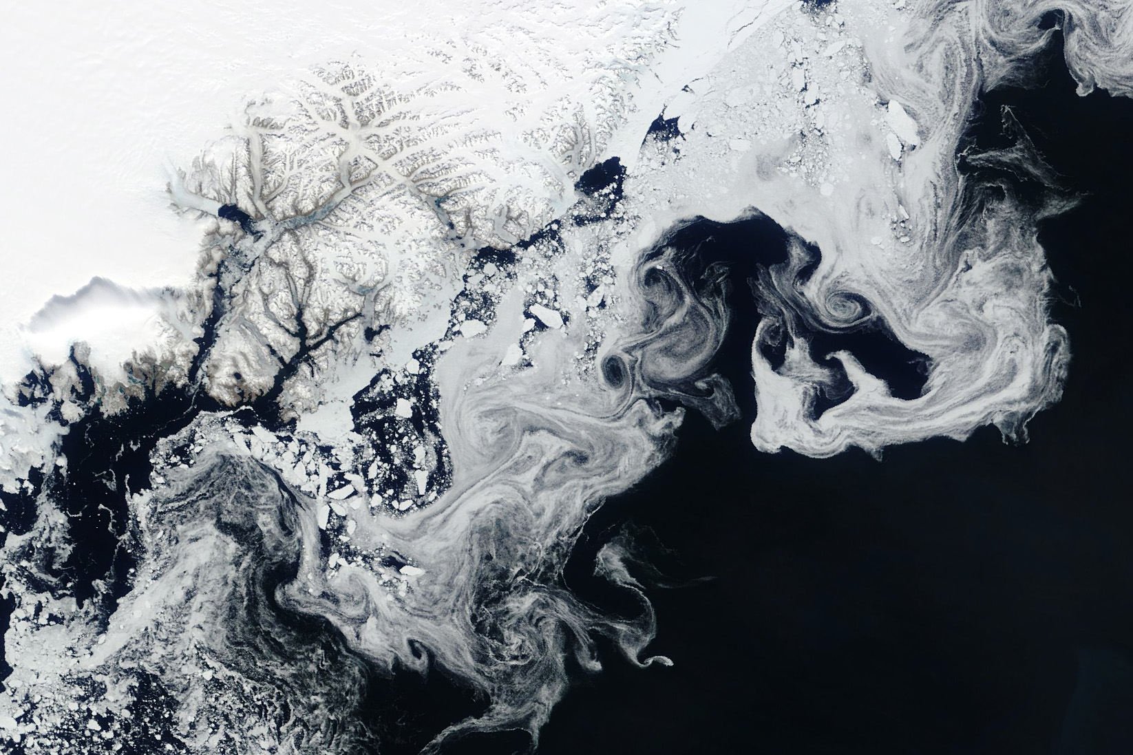
NASA's Terra satellite captured floating fragments of sea ice as ocean currents carried them south along Greenland's east coast on June 4, 2024.
This ice traveled from the Fram Strait, a 450-kilometer (280-mile)-wide passage between Greenland and Svalbard, to the Arctic Ocean. Along the journey, it breaks into smaller pieces and starts to melt in warmer ocean waters, creating the wispy patterns seen here.
/Public Release. This material from the originating organization/author(s) might be of the point-in-time nature, and edited for clarity, style and length. Mirage.News does not take institutional positions or sides, and all views, positions, and conclusions expressed herein are solely those of the author(s).View in full here.


