- Curiosity
- Science
- News and Features
- Multimedia
- Mars Missions
- All Planets
2 min read
Earth planning date: Monday, July 8, 2024
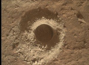
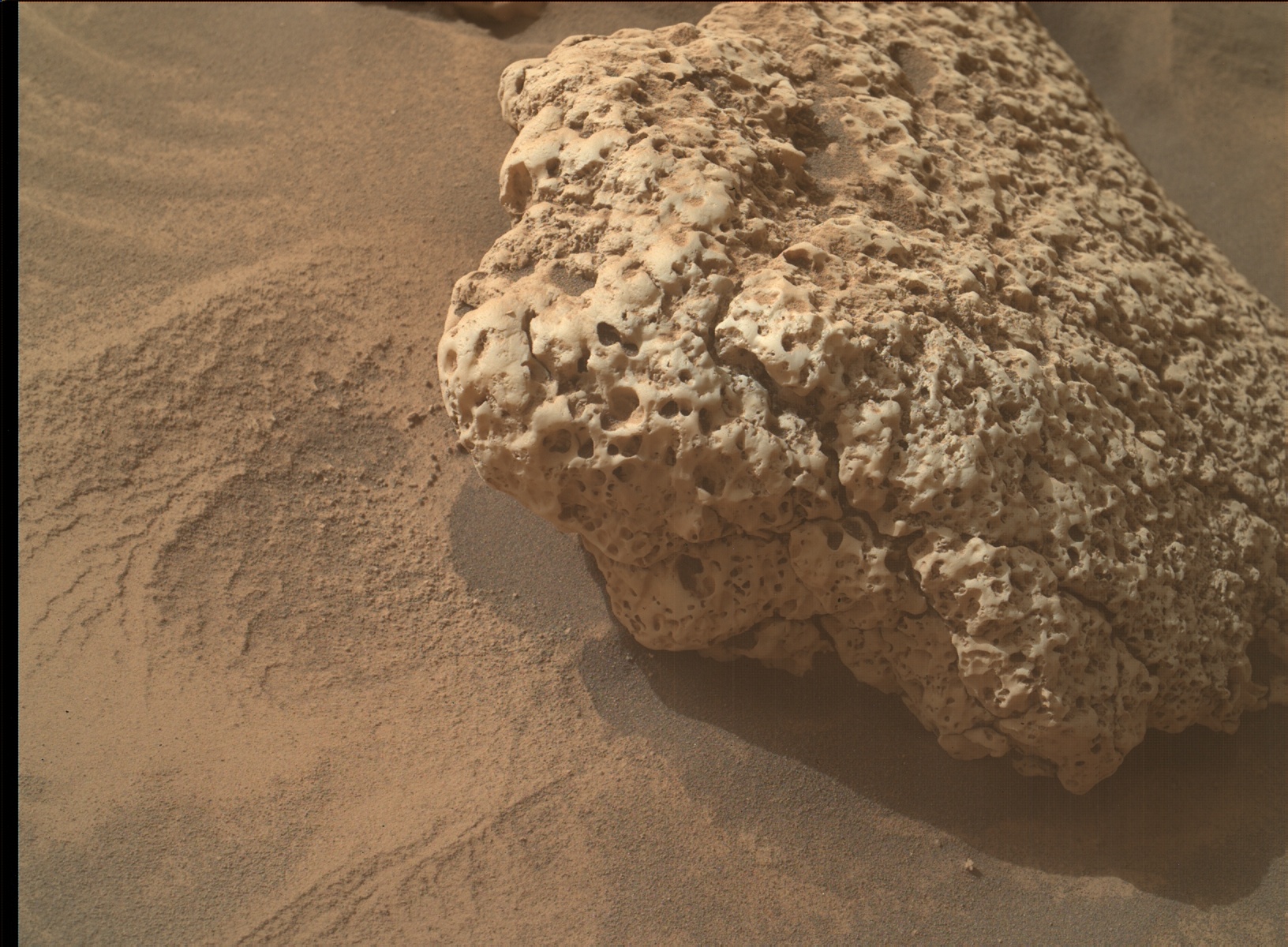
And just like we planned, Curiosity successfully drove about 11 meters (about 36 feet) after a 27-sol drill campaign at Mammoth Lakes! Not so fast, though, these rocks are just too interesting to leave behind so quickly. Instead of high-tailing it uphill like we usually do after a drill campaign, we're staying put for another plan to get as much contact science on these diversely-toned rocks with mysterious origins and vugs (geologic term for the cavities in the rock) galore. It's been a high priority to get as much color documentation of the clasts in the area, so a plan like this has kept my team busy commanding the Mastcams!
The first sol of this plan includes a long, 90-minute remote science block including about 50 minutes of ChemCam LIBS and RMI, about 32 minutes of Mastcam images, and a six-minute dust devil movie taken by Navcam. ChemCam is using its one-LIBS-per-sol on a conglomeratic block target named "Mount Baxter," and an RMI of Echo Ridge to the south. Mastcam is taking a 12-image mosaic of Mount Baxter after the LIBS work is done, and a huge 54-image mosaic to the east of Echo Ridge called "Stubblefield Canyon." After the mast instruments are done, our rover will take about a four-hour long nap and wake up to unstow our arm. Arm activities this plan include two vug-tastic targets named "Lake Dorothy" and "Palisade Glacier," both imaged by MAHLI and investigated by APXS. Curiosity is back to sleep by about 22:50, which sounds like my perfect sleep schedule.
The second sol of this plan includes a 60-minute remote science block containing about 45 minutes of ChemCam LIBS and RMI, only about six minutes of Mastcam images, and a whopping two hours of dust devil and environmental monitoring by Navcam. With 27 sols at our last location, we noticed significant wind motion between repeated images, and Navcam monitoring helps us keep track of how windy it is. Our rover will take another midday nap and wake up in the evening for a bonus APXS integration on Lake Dorothy, helping raise the signal-to-noise ratio and uncover more secrets (and questions) these Martian rocks have been keeping for millions of years.
Written by Natalie Moore, Mission Operations Specialist at Malin Space Science Systems