- Curiosity
- Science
- News and Features
- Multimedia
- Mars Missions
- All Planets
3 min read
Earth planning date: Friday, July 12, 2024
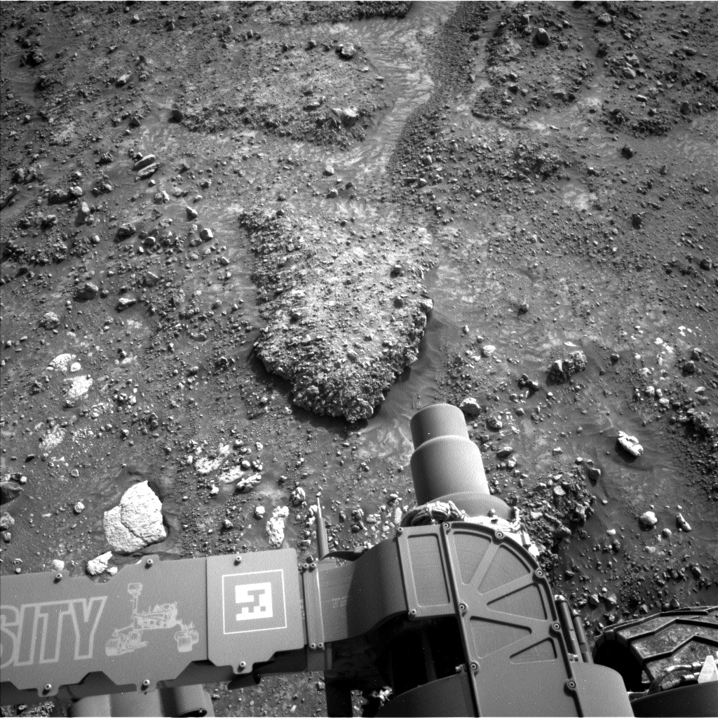
Curiosity, now heading uphill from the Mammoth Lakes drill site, has focused on a very interesting exposure of conglomerate rocks, consisting of pebbles cemented together by a fine-grained matrix material. On Earth, conglomerate rock is associated with downhill flows of rock and soil mixtures, often in a water-rich environment, so our science team is excited to find similar rocks on Mars.
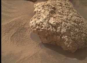
The local exposure of this unusual Martian deposit has been named "Stubblefield Canyon," honoring the headwaters of the stream forming Rancheria Falls, which tumbles into Yosemite National Park's Hetch Hetchy reservoir. All targets in this area of Mount Sharp are named after geological features near the town of Bishop, California, which sits at the foot of the Sierra Nevada mountains in the Owens Valley of California. Curiosity's last drive ended at a detached, rubbly conglomerate slab, dubbed "Wishbone Lake" after a Y-shaped lake in upper Lamarck Lake Canyon near Mono Lake. The image above shows the Wishbone Lake slab of conglomerate rock in the rover workspace. Over the weekend, the team will investigate this target and image the surrounding terrain, collecting evidence about the formation of conglomerate rocks on Mars.
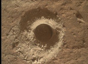
On Wednesday, Curiosity successfully completed its MAHLI imaging of "Donohue Pass" and ChemCam laser spectroscopy of "Negit Island," followed by a 3-meter drive (about 10 feet) to Wishbone Lake. During the current plan, APXS will analyze two pebbles within the Wishbone Lake slab, "Arrowhead Spire" and "Cattle Creek." Arrowhead Spire honors a 100-foot vertical spike of granite near Yosemite Point, above Yosemite Valley. Cattle Creek is named for a stream that flows from a hanging valley into the Twin Lakes canyon near Bridgeport, California. MAHLI will image Cattle Creek, then do a 4×1 mosaic from a distance of 25 centimeters (about 10 inches) along the edges of Wishbone Lake, centered on the Arrowhead Spire pebble. ChemCam will take laser spectra of Arrowhead Spire, as well as the "Eocene Peak" matrix material target, named for an 11,500-foot peak in the Sawtooth Ridge along the northeastern boundary of Yosemite National Park.
Using its telescopic RMI camera, ChemCam will image upper Gediz Vallis Ridge and a distant ridgeline along our future drive path. Mastcam will photograph the ChemCam laser targets, as well as interesting portions of the Stubblefield Canyon conglomerate exposure, the Mammoth Lakes drill site as seen from our new location, and an interesting linear ridge. On sol 4244, Curiosity will drive 20 meters (about 66 feet) along our path toward "Fairview Dome," followed by post-drive imaging and AEGIS observations. Atmospheric studies during the current plan include a Navcam dust devil movie and large dust devil survey, early morning Navcam zenith and suprahorizon cloud movies, Navcam deck imaging, Navcam and Mastcam dust opacity measurements, and a late afternoon Mastcam sky survey. Next week, we expect to explore Fairview Dome, then resume our climb up Mount Sharp.
Written by Deborah Padgett, Curiosity Operations Product Generation Subsystem Task Lead at NASA's Jet Propulsion Laboratory