- Curiosity Home
- Science
- News and Features
- Multimedia
- Mars Missions
- The Solar System
2 min read
Earth planning date: Friday, Aug. 9, 2024
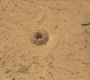
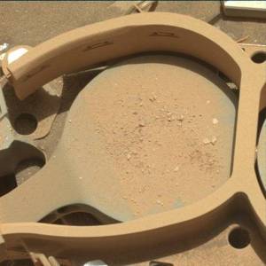
The focus for this three-sol weekend plan is delivering a portion of the Kings Canyon drill sample to SAM for Evolved Gas Analysis (EGA), following on from a successful CheMin analysis. The CheMin and SAM analyses, coupled with APXS and ChemCam analyses, will tell us about the composition and mineralogy of this block within the Gediz Vallis channel deposit. We can compare it to the composition and mineralogy of the intriguing Mammoth Lakes drilled sample at Whitebark Pass, which was near the elemental sulfur blocks, and also within the Gediz Vallis deposit, as well as to the bedrock outside the channel and other previous drilled samples. This will help inform the source(s) of the blocks, which could be derived from higher up on Mount Sharp.
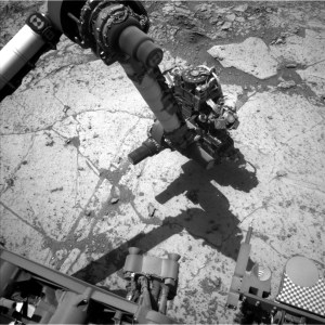
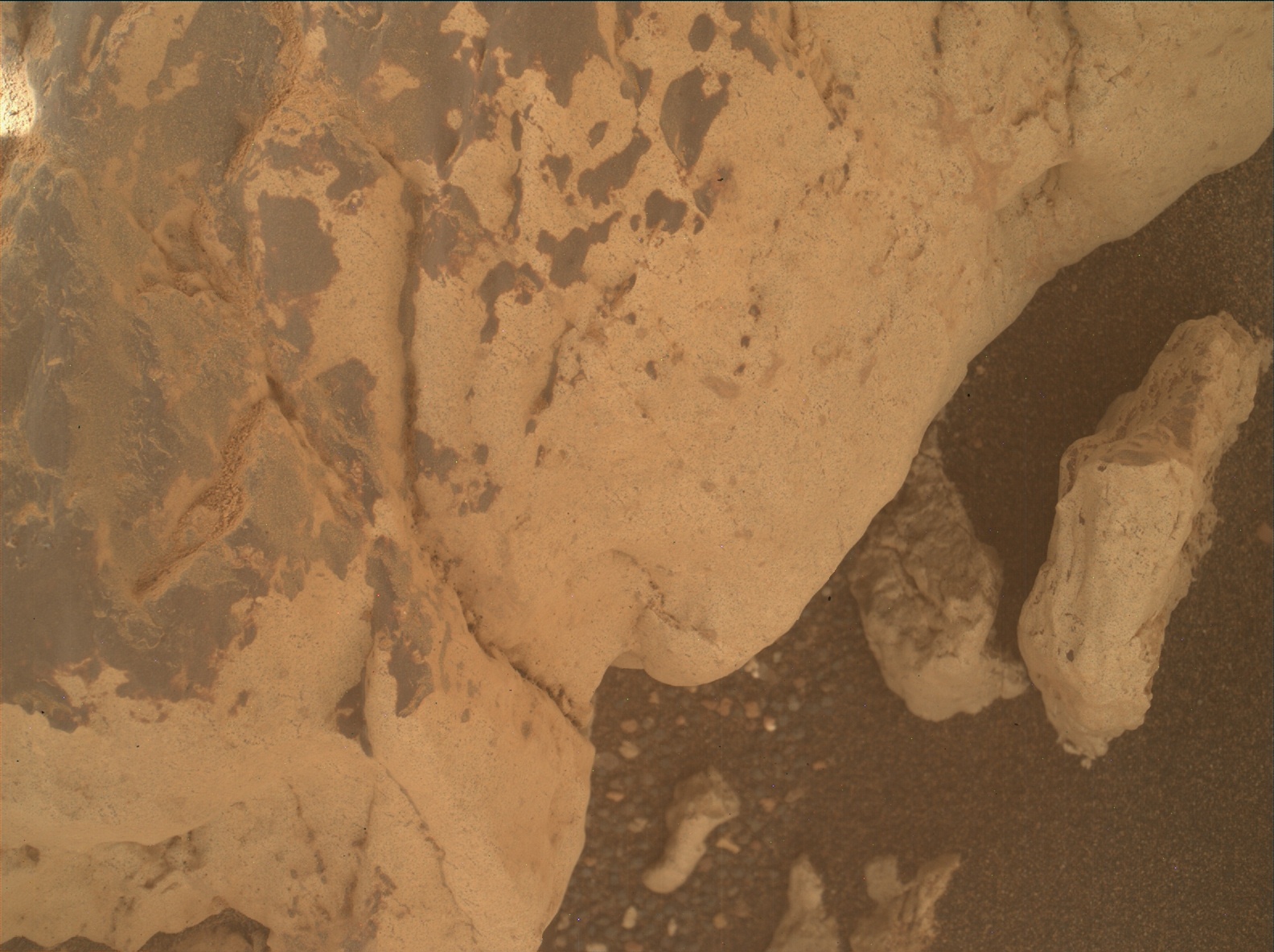
To further characterize the Kings Canyon block and immediate vicinity, we will acquire three ChemCam LIBS analyses. The "Gabbot Pass" target is on the same light-toned rock as the drill target. "New Army Pass" will investigate the edge of the drilled block, which exhibits textural and tonal similarities to an interesting previous APXS target, "Discovery Pinnacle." Finally, "Bridalveil Falls" is on a freshly broken, bright rock on the edge of the drilled block. Mastcam will provide documentation imaging of the three targets.
Looking further afield, we continue to image the stunning scenery surrounding us from this vantage point. We planned a ChemCam long distance remote imager (LD RMI) mosaic of the Gediz Vallis channel form to the south, and an extension of a Mastcam mosaic of the Milestone Peak area of the deposit. These mosaics will help us to further characterize the Gediz Vallis deposits, and hopefully the processes responsible for their emplacement (e.g., debris flow or rock avalanche). We will also acquire a Mastcam mosaic of the Texoli butte, which represents a cross section of the rock layers that we will eventually drive over when we leave the Gediz Vallis deposit and continue climbing Mount Sharp.
It isn't just about the rocks though! The environmental and atmospheric science team also have several observations in this plan to monitor changes in the atmosphere. These include Mastcam tau and Navcam line of sight observations, as well as Navcam zenith, suprahorizon and dust devil movies. Standard DAN, RAD and REMS activities round out the plan.
Written by Lucy Thompson, Planetary Geologist at University of New Brunswick