- Curiosity Home
- Science
- News and Features
- Multimedia
- Mars Missions
- The Solar System
2 min read
Earth planning date: Monday, Aug. 12, 2024
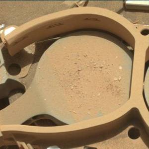
The SAM EGA over the weekend was successful, and that means we're well on our way to planning the GCMS (Gas Chromatograph Mass Spectrometry) on our "Kings Canyon" drill sample! GCMS is an energy-intensive activity, so we'll be using today's two-sol plan mainly for recharging our battery and prepping SAM by cleaning its GC column with high temperatures (like you'd clean your own oven!). We can still afford about 75 minutes of remote sensing over both sols this plan and are using it for our usual ChemCam, Mastcam, and Navcam activities.
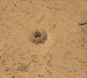
On the first sol, ChemCam is kicking things off with a LIBS (Laser Induced Breakdown Spectrometer) on "The Major General" - some crunchy light-toned bedrock about 9 feet away (about 2.8 meters) - then will capture a long-distance 10-frame RMI of the Gediz Vallis channel floor to the south. Mastcam finishes off the first sol's 72-minute science block with an M100 image of The Major General LIBS spots and a 68-frame stereo mosaic of the midfield terrain to fill in what's left of the midfield with M100. We'll nap until about 15:15, when we'll wake back up to take just two M100 images near the RSM hardstop at the same timing as a previous mosaic to make sure we have continuous coverage across the hardstop. SAM's GC column clean is planned between 21:00 and 01:00; overnight between our two sols.
On the second sol, we'll have our second remote sensing block around 11:00 for 73 minutes. ChemCam is planning a second LIBS target on "Dewey Point" - a slab of light-toned bedrock about 13 feet away (about 3.9 meters) - a passive-spectrum observation of a dark float block named "Waller Minaret," and another long-distance four-frame RMI of southern Kukenan butte to the southeast. Mastcam has just a single M100 image of Dewey Point's LIBS spots this sol so that Navcam can complete some environmental movies to hopefully capture some dust devils and maybe even some clouds!
Written by Natalie Moore, Mission Operations Specialist at Malin Space Science Systems