An international marine research team guided by Cornell expertise has successfully completed an ambitious drilling project to investigate the plate boundary fault that ruptured during the Tohoku earthquake that devastated Japan in 2011.
At an extreme water depth of 7 kilometers, the team used the Japanese drilling vessel Chikyu to drill a series of deep boreholes, including a sub-seafloor borehole observatory that intersects the fault nearly 1 kilometer beneath the seafloor. They also conducted geophysical logging and coring, and reinstalled temperature sensors in a previous observatory well across the fault - a feat that had never before been attempted at such depths.
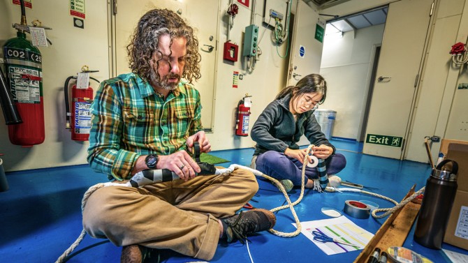
Patrick Fulton, the David Croll Sesquicentennial Fellow and assistant professor of earth and atmospheric sciences in Cornell Engineering, and Huiyun Guo, a postdoctoral researcher at CalTech, prepare sensors for a borehole observatory.
The team's geologic and hydrologic testing will increase understanding of subduction zones and lead to better preparation for large earthquakes and tsunamis, according to Patrick Fulton, the David Croll Sesquicentennial Fellow and assistant professor of earth and atmospheric sciences in Cornell Engineering, who served as a co-chief scientist and the project's science lead for the observatories.
"The main technical challenge with this project is that we're in 7 kilometers water depth, and then we go another kilometer underground, and so that is ultra-deep water. There are not many ships that that can operate in that extreme water depth," Fulton said. "It's kind of like a NASA mission."
Fulton also served as co-PI on the Cornell University Borehole Observatory (CUBO), a platform to directly study the temperature, permeability and other characteristics of the rock deep beneath the Ithaca campus to explore the viability of warming the campus with Earth Source Heat.
The drilling expedition - officially known as the Tracking Tsunamigenic Slip Across the Japan Trench (JTRACK) project of the International Ocean Discovery Program (IOPD) - followed a similar effort in 2012, when Fulton and the IODP first ventured to the Japan Trench to study how and where the magnitude 9.1 earthquake - one of the largest ever recorded - originated.
In that rupture, the shallowest part of the fault slipped 50 to 60 meters, and "the seafloor itself jumped half a football field to the east over the course of a minute or two," triggering a catastrophic tsunami that was much larger than anyone had expected, according to Fulton.
By studying the fault's properties and conditions soon after the earthquake, the researchers sought to determine what caused such a significant rupture and why it had been so difficult to predict. But the team needed to go to great lengths - and depths - to get answers.
"Before we did this in 2012, no one had really tried to essentially drill a kilometer underground in such extreme water depth, let alone build an observatory or put geophysical tools down to try to characterize what's in there," Fulton said.
The observatory gave the team an up-close look at the conditions within the fault, revealing an anomalous heat signal caused by frictional heating on the fault during the earthquake. The unique data indicated that the fault was very weak. The observatory also revealed how, during aftershocks, faults and fractures opened up, with springs of water moving through them, which ultimately change the stress conditions within the system.
"So now, 12 years later, going back, the down-going plate is still moving at about 10 centimeters per year. Has it stuck in certain spots? Has the fault started to build up stress, enough that maybe the shallow part could have another big earthquake? We want to see how those processes have evolved," Fulton said. "All these things - coring, logging and observatory recording - we could just do little bits of 12 years ago; now we want to do much more deeper characterization of all the faults and fractures, and also look at the incoming plate before it subducts."
c
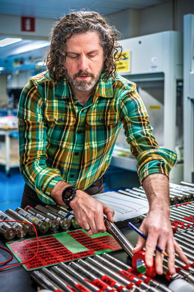
Patrick Fulton served as a co-chief scientist and the project's science lead for the borehole observatories.
In September, a team of about 150 people, ranging from scientists and engineers to drillers and laborers, boarded Chikyu and returned to the trench. While they had previously built a borehole observatory at the site, drilling into a fault does not get any easier, even with a seasoned team.
"The big challenge is reentering the hole. There is no motor or anything like a remote control for the drill bit to get into the spot," Fulton said. "Instead, all that steel pipe is like a wet spaghetti noodle underneath the ship."
Aided by a fiberoptic cable with lights, sonar and an underwater TV camera lowered to the seafloor, the ship nudged back and forth, swaying the drill pipe beneath it, until it hit the right spot.
"It can take hours. And then right when we're above the hole, we say, 'now, now, now.' And the drillers lower the pipe," Fulton said. "In terms of dimensions, it's like threading a needle from the top of the Empire State Building."
Once in position, they drilled down more than 900 meters across the fault, then built and installed the observatory, which is essentially a long steel tube containing ultra-sensitive sensors to measure the fluid flowing through the fractures and frictional heat.
"A lot of what we're looking at this time is trying to understand the hydrology of the fault zone, the plumbing of the system," Fulton said. "I think in the past 12 years, we've also learned a lot about how the hydrology seems to be related to whether some places along the fault just creep along, or whether they get stuck and eventually rupture in earthquakes."
To install and then retrieve the sensors - which were encased in titanium, so they won't implode under the ocean pressure - the team designed a kind of upside-down funnel that covered, and attached to, the wellhead. A winch was lowered with the sensors, to move them through the drill pipe.
The team also drilled into the fault to collect geophysical data through a process known as logging, which will enable the researchers to determine the current stress conditions underground. They then took core samples through the fault zone and the incoming Pacific plate down below the fault, and at a site further offshore before it subducts within the trench. The project concluded, in December, with the construction of a new, even deeper borehole observatory.
Fulton expects the data they've collected will generate a number of research papers in the coming years.
"It's a big project. We don't have the budget of Europa Clipper, but, I think, it's in that kind of style," Fulton said. "Lots of big earthquake science and earthquake physics knowledge came from our previous expedition. We're back there, and we're already learning a lot."


