Geneva, Switzerland - 2020 was a year of both challenges and accomplishments for UNITAR-UNOSAT. Our mapping teams delivered 1,136 products and services based on over 300 analyses to partners in 59 countries, with an emphasis on Sub-Saharan and Northern Africa & Western and South-Eastern Asia, but also Latin America and the Caribbean. Much of the data produced was used to assess exposure to and impact of hazards, but also to generate potential flood scenarios for refugee camp planning, assess damages, conduct sectoral analyses, and more. Throughout the year we also successfully designed and implemented several capacity development activities: UNITAR-UNOSAT delivered 16 learning-related events in 2020 to 471 beneficiaries consisting mostly of government officials, 6 of which were web-based and 10 of which took place face-to-face (4 in the Pacific, 4 in Africa, 2 in Asia). Themes included Geospatial Information Technology (GIT) applications for Disaster Risk Reduction (DRR), risk financing, climate resilience, emergency response, agriculture, Monitoring & Evaluation (M&E), peace and security, investigations & respect of IHL monitoring. We also reached out to stakeholders in the context of awareness-raising workshops to share our vision with decision and policy-makers in Africa of the benefits of GIT for DRR, climate resilience, management of natural resources, and other applications as well as the latest trends in the field.
Our capacity development activities received positive feedback from participants across the board in 2020 and an average of 92% expressed satisfaction with the courses offered, finding them useful overall. Some examples of activities in 2020 include developing flood risk management and flood forecasting skills in Guyana, enhancing operational planning and decision-making in disaster situations using Geospatial Information Technology (GIT) in Mozambique and Uganda, using flood forecasting, early warning systems, and GIT for flood risk management in ECOWAS member states, and using GIT to investigate human rights violations, among other training.
However, we did not yet reach another important target: gender balance. Indeed, 30% of training participants in 2020 were women compared to 70% men. As a supporter of the Agenda 2030 for Sustainable Development, UNOSAT advocates for Gender Equality and the Empowerment of Women and Girls (SDG 5) in all its activities and services. Throughout the year, efforts were made to introduce as many women as possible to remote sensing concepts and tools, in order to address the gap of female talent in Science, Technology, Engineering and Math (STEM) careers. The different stakeholders were actively encouraged to promote women's participation in and contribution to UNITAR-UNOSAT's activities. Beyond promoting gender-balanced participation, we are keen to ensure an inclusive and enabling environment. Therefore, UNOSAT is continuing its efforts to develop more gender-responsive training attuned to cultural specificities and group dynamics, notably by introducing gender objective assessment in the activities evaluation. Despite the progress made in the past years, and the increase in women's participation, our determination to reach our goal of gender balance remains intact for all of the courses and workshops we offer.
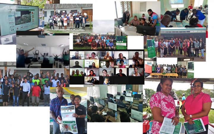
As lead of the CommonSensing project*, we are very proud of the results achieved in 2020 and would like to extend our thanks to all partner organizations, including Satellite Applications Catapult, the Commonwealth Secretariat, Devex, UK Met Office, University of Portsmouth, Sensonomic, Spatial Days and also a special thanks to the University of the South Pacific for their close collaboration as they opened their doors to us for several events. In 2020, CommonSensing delivered 6 technical trainings and 20 technical awareness-raising events benefiting 1,053 participants and 46 ministries, departments, or agencies in Fiji, Solomon Islands, and Vanuatu; in addition, 16 outreach events allowed us to share details of the project with over 6,000 attendees. The project is expected to come to a close this year with our targets being reached, including capacity building goals and embedding specialists within government structures to ensure local data systems, knowledge, and decision-making benefit from the added capabilities of CommonSensing, notably to sustainably secure climate financing.
*The CommonSensing project is financed by the UK Space Agency through their International Partnership Programme (IPP) funded from the BEIS Global Challenges Research Fund (GCRF).
Despite the challenges raised by the COVID-19 pandemic, the digital nature of Remote Sensing allowed "business as usual" for our mapping services. Regarding capacity development activities, the situation accelerated our adoption of e-learning and blended learning solutions for our beneficiaries given the decline in travel opportunities to deliver face-to-face. At the same time, our staff was able to work remotely with ease during the pandemic and provide valuable GIS and remote sensing products and services to partners from virtually anywhere in the world. All our activities were delivered in accordance with sanitary and health guidelines from the UN and local authorities.
We could not achieve the above without our numerous supporters and partners, comprising various national Ministries and agencies, United Nations Organizations and Mechanisms, Space Agencies, and NGOs.
In terms of innovation, 2020 was marked by the ramping up use of artificial intelligence in our flood rapid mapping operations, thereby accelerating and automating our mapping efforts for the benefit of national disaster management authorities. We also continued to explore and implement new applications of GIT by using remote sensing to support civil and electoral registries validation in Vanuatu for example.
In 2021 we will continue innovating and serving member states, UN agencies, and other organizations with data, analysis, and capacity development activities to strengthen skills in the use of GIT for various thematic applications. In addition to delivering beneficial outcomes and ensuring sustainable impact, we will continue to focus on the added value that GIT can bring to humanitarian and sustainable development projects to further develop our footprint and effectively support our partners and donors to honor our 20-year anniversary.
To stay informed on our activities and upcoming celebrations, follow us on Twitter


